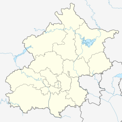
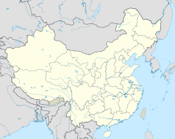
Dayushu Town (simplified Chinese: 大榆树镇; traditional Chinese: 大榆樹鎮; pinyin: Dàyúshù Zhèn) is a town in the Yanqing District of Beijing.[1] It borders Baiquan Subdistrict, Yanqing and Shenjiaying Towns to the north, Jingzhuang Town to the east, Badaling Town to the south, and Kangzhuang Town to the west. In the year 2020, it had a population of 16,166.[2]
Dayushu Town
大榆树镇 | |
|---|---|
 Section of the Great Wall south of Xiao Zhangjiakou Village, 2004 | |
 Location within Yanqing District | |
| Coordinates: 40°26′09″N 116°01′20″E / 40.43583°N 116.02222°E | |
| Country | China |
| Municipality | Beijing |
| District | Yanqing |
| Village-level Divisions | 1 community 25 villages |
| Area | |
• Total | 60.1 km2 (23.2 sq mi) |
| Elevation | 516 m (1,693 ft) |
| Population (2020) | |
• Total | 16,166 |
| • Density | 270/km2 (700/sq mi) |
| Time zone | UTC+8 (China Standard) |
| Postal code | 102103 |
| Area code | 010 |
The name Dayushu (Chinese: 大榆树; pinyin: Great Elm) comes from a large elm tree that used to exist within the region during the Ming dynasty.[3]
Geography
editDayushu Town is located on the foothill of Yan Mountain Range. Datong–Qinhuangdao railway, National Highway 110 and Beijing–Ürümqi Expressway traverse through the town.
History
edit| Time | Status | Part of |
|---|---|---|
| 1948 - 1952 | 1st District | Yanqing County, Chahar |
| 1952 - 1953 | Yanqing County, Hebei | |
| 1953 - 1956 | Jiangjiatai Township
Yanghuzhuang Township | |
| 1956 - 1958 | Dayushu Township
Xiatun Township | |
| 1958 - 1961 | Dayushu Production Team
Xiatun Production Team, both within Dengta People's Commune |
Yanqing County, Beijing |
| 1961 - 1966 | Dayushu People's Commune
Xiatun People's Commune | |
| 1966 - 1981 | Gaomiaotun People's Commune
Xiatun People's Commune | |
| 1981 - 1983 | Dayushu People's Commune
Xiatun People's Commune | |
| 1983 - 2000 | Dayushu Township
Xiatun Township | |
| 2000 - 2015 | Dayushu Town | |
| 2015–present | Yanqing District, Beijing |
Administrative divisions
editAt the time of writing, Dayushu Town consists of 26 subdivisions, including these 1 communities and 25 villages:[4]
| Subdivision Names | Name Transliterations | Type |
|---|---|---|
| 大榆树镇 | Dayushuzhen | Community |
| 姜家台 | Jiangjiatai | Village |
| 陈家营 | Chenjiaying | Village |
| 杨户庄 | Yanghuzhuang | Village |
| 阜高营 | Fugaoying | Village |
| 奚官营 | Xiguanying | Village |
| 下辛庄 | Xia Xinzhuang | Village |
| 上辛庄 | Shang Xinzhuang | Village |
| 宗家营 | Zongjiaying | Village |
| 大榆树 | Dayushu | Village |
| 高庙屯 | Gaomiaotun | Village |
| 刘家堡 | Liujiapu | Village |
| 北红门 | Bei Hongmen | Village |
| 南红门 | Nan Hongmen | Village |
| 东桑园 | Dong Sangyuan | Village |
| 大泥河 | Da Nihe | Village |
| 小泥河 | Xiao Nihe | Village |
| 小张家口 | Xiao Zhangjiakou | Village |
| 下屯 | Xiatun | Village |
| 东杏园 | Dong Xingyuan | Village |
| 西杏园 | Xi Xingyuan | Village |
| 岳家营 | Yuejiaying | Village |
| 簸箕营 | Bojiying | Village |
| 新宝庄 | Xinbaozhuang | Village |
| 程家营 | Chengjiaying | Village |
| 军营 | Junying | Village |
See also
editReferences
edit- ^ "Dayushu Town, Miyung, Beijing, China". www.aldpage.com. Archived from the original on 2018-06-25. Retrieved 2018-06-25.
- ^ 统计局. "北京市延庆区第七次全国人口普查公报[1]". www.bjyq.gov.cn. Retrieved 2022-10-31.
- ^ a b 李立国; 李万钧; 吴世民, eds. (2013). 中华人民共和国政区大典, 北京市卷. Beijing: 中国社会出版社. ISBN 978-7-5087-4058-4. OCLC 910451741.
- ^ "2021年统计用区划代码和城乡划分代码". www.stats.gov.cn. Retrieved 2022-10-31.

