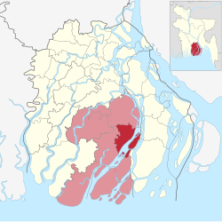
Dashmina (Bengali: দশমিনা) is an upazila of Patuakhali District in the Division of Barisal, Bangladesh.[4]
Dashmina
দশমিনা | |
|---|---|
| Dashmina | |
 | |
| Coordinates: 22°17′N 90°35.4′E / 22.283°N 90.5900°E | |
| Country | |
| Division | Barisal Division |
| District | Patuakhali District |
| Area | |
• Total | 351.87 km2 (135.86 sq mi) |
| Population | |
• Total | 130,402 |
| • Density | 370/km2 (960/sq mi) |
| Time zone | UTC+6 (BST) |
| Postal code | 8630[2] |
| Area code | 04423[3] |
| Website | Official Map of the Doshmina Upazila |
Geography
editDashmina is located at 22°17′00″N 90°35′25″E / 22.2833°N 90.5903°E. It has 28,490 households and a total area of 351.87 km2. The Upazila Headquarters are situated in Dashmina Sadar. It is situated on the Bank of the river Tetulia.
Among the 6 unions of Dashmina including the Sadar at the centre, two of them are in the north of Dashmina Sadar namely Bashbaria and Bahrampur union. Bashbaria is situated on the bank of the river Tetulia. North Border of both Bahrampur and Bashbaria union ends up with starting of Baufal upazila. Rono Gopaldi and Betagi Shankipur union is situated on the north western part of Dashmina Sadar and finally the Alipura union covers the southern part of this historic Upazila which ends up with starting of Galachipa upazila.
Demographics
editAccording to the 2011 Census of Bangladesh, Dashmina Upazila had 28,490 households and a population of 123,388. 31,102 (25.21%) were under 10 years of age. Dashmina has a literacy rate (age 7 and over) of 48.7%, compared to the national average of 51.8%, and a sex ratio of 1048 females per 1000 males. 19,252 (15.60%) lived in urban areas.[5][6]
According to the 1991 Bangladesh census, Dashmina had a population of 106,539. Males constituted 49.5% of the population, and females 50.5%. The population aged 18 or older was 52,137. Dashmina had an average literacy rate of 29.5% (7+ years), compared to the national average of 32.4%.
Administration
editDashmina Upazila is divided into seven union parishads:
- 1 No Rangopaldi
- 2 No Alipur
- 3 No Betagi Shankipur
- 4 No Dashmina Sadar
- 5 No Bahrampur
- 6 No Bashbaria
- 7 No Char Bohranuddin.
- The union parishads are subdivided into 51 mauzas and 55 villages.[7]
Education
editAt present it holds three colleges, three Boys' high schools, two girls' schools, an Alia Madrasa and a number of government and non government primary schools.
- Abdur Rashid Talukdar Degree
College
- Arojbegi Laboratory College
- Alipura College
- Doli Akbar Mohila College
- Dashmina Govt. Model High School
- Gachhani Secondary School
- Dakkhin Daspara A. Gani Girls Dakhil Madrasah
- Begum Arefatunnessa Girls High School
- Banglabazar Girls High School
- Hazirhat Nimmo maddhomik
Biddyalaoy
- Dashmina Senior Fazil Madrasha
- BM Labrotary School
- Bahrampur High School
See also
editReferences
edit- ^ a b Population and Housing Census 2022 - District Report: Patuakhali (PDF). District Series. Dhaka: Bangladesh Bureau of Statistics. June 2024. ISBN 978-984-475-267-2.
- ^ "Bangladesh Postal Code". Dhaka: Bangladesh Postal Department under the Department of Posts and Telecommunications of the Ministry of Posts, Telecommunications and Information Technology of the People's Republic of Bangladesh. 21 October 2024.
- ^ "Bangladesh Area Code". China: Chahaoba.com. 18 October 2024.
- ^ Gazi Shahidul Islam (2012). "Dashmina Upazila". In Sirajul Islam and Ahmed A. Jamal (ed.). Banglapedia: National Encyclopedia of Bangladesh (Second ed.). Asiatic Society of Bangladesh.
- ^ "Community Tables: Patuakhali district" (PDF). bbs.gov.bd. 2011.
- ^ "Bangladesh Population and Housing Census 2011 Zila Report – Patuakhali" (PDF). bbs.gov.bd. Bangladesh Bureau of Statistics.
- ^ "District Statistics 2011: Patuakhali" (PDF). Bangladesh Bureau of Statistics. Archived from the original (PDF) on 13 November 2014. Retrieved 14 July 2014.