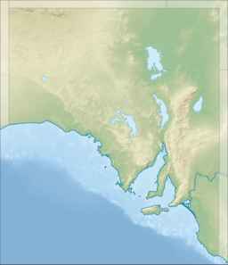
D'Estrees Bay (French: Baie D'Estrees) is a bay in the Australian state of South Australia located on the southern coast of Kangaroo Island about 39 kilometres (24 miles) south of Kingscote, the Island's principal centre.
| D'Estrees Bay | |
|---|---|
 | |
Location in South Australia | |
| Location | Kangaroo Island, South Australia |
| Coordinates | 35°55′00″S 137°39′02″E / 35.91656209°S 137.65046840°E[1] |
| Type | Bay |
| Basin countries | Australia |
| Max. length | 14 km (8.7 mi)[2] |
| Max. depth | 27 m (89 ft)[2] |
| Settlements | Haines D'Estrees Bay[1] |
D’Estrees Bay was named in 1803 by Peron and Freycinet of the Baudin expedition to Australia after Victor-Marie d'Estrées, a Marshal of France.[1][3]
The bay extends from Point Tinline in the south west to Point Reynolds in the north east,[2] with the beach being sandy and accessible for most of the bay's length.
The western side of the bay contains a settlement consisting of “single detached dwellings and recreation facilities for holiday makers and permanent residents.”[4]
The land at the bay's south west end is currently part of the Cape Gantheaume Conservation Park.[4]
Shipwrecks
editOn the night of 25 November 1853 the steamer Osmanli, Captain Corbett, returning to Adelaide from Melbourne, struck a reef and sank in D'Estrees Bay. Some sixty persons were aboard, and all made it safely to shore in the boats, but passenger Morris Marks lost a quantity of gold.[5]
See also
editReferences
edit- ^ a b c "Search result for "D'Estrees Bay (Bay)" (Record no SA0017650) with the following layers selected - "Suburbs and Localities" and "Place names (gazetteer)"". Property Location Browser. Government of South Australia. Archived from the original on 12 October 2016. Retrieved 1 June 2016.
- ^ a b c South Australia. Department of Marine and Harbors (DMH) (1985), The Waters of South Australia a series of charts, sailing notes and coastal photographs, Dept. of Marine and Harbors, South Australia, pp. Chart11, ISBN 978-0-7243-7603-2
- ^ Robinson, A. C.; Canty, P.; Mooney, T.; Rudduck, P. (1996). "South Australia's offshore islands" (PDF). Australian Heritage Commission. p. 119. Retrieved 13 December 2013.
- ^ a b "Development Plan, Kangaroo Island Council, Consolidated – 20 February 2014" (PDF). Department of Planning, Transport and Infrastructure. pp. 127 and 329–333. Retrieved 8 March 2016.
- ^ "Wreck of the Osmanli Steamer in D'Estrees Bay, Kangaroo Island". South Australian Register. South Australia. 30 November 1853. p. 2. Retrieved 20 April 2020 – via Trove.
