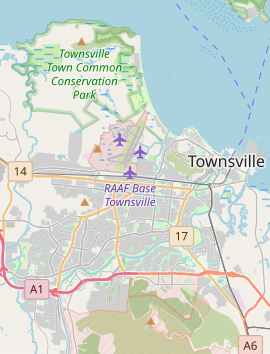
Cosgrove is a suburb of Townsville in the City of Townsville, Queensland, Australia.[2] In the 2021 census, Cosgrove had a population of 665 people.[1]
| Cosgrove Townsville, Queensland | |||||||||||||||
|---|---|---|---|---|---|---|---|---|---|---|---|---|---|---|---|
 | |||||||||||||||
| Coordinates | 19°16′18″S 146°42′48″E / 19.2716°S 146.7133°E | ||||||||||||||
| Population | 665 (2021 census)[1] | ||||||||||||||
| • Density | 184.7/km2 (478/sq mi) | ||||||||||||||
| Postcode(s) | 4818 | ||||||||||||||
| Area | 3.6 km2 (1.4 sq mi) | ||||||||||||||
| Time zone | AEST (UTC+10:00) | ||||||||||||||
| Location |
| ||||||||||||||
| LGA(s) | City of Townsville | ||||||||||||||
| State electorate(s) | Townsville | ||||||||||||||
| Federal division(s) | Herbert | ||||||||||||||
| |||||||||||||||
Geography
editCosgrove is bordered by the North Coast railway line to the north with the North Townsville Road (formerly the Bruce Highway) running parallel and immediately south of the railway line. The Bohle River forms the western boundary.[3]
History
editThe suburb was named after General Sir Peter Cosgrove, the former head of the Australian Defence Force and leader of Queensland Government taskforce for the rebuilding of Innisfail region after cyclone Larry in March 2006.[2]
Demographics
editIn the 2016 census, Cosgrove had a population of 285 people.[4]
In the 2021 census, Cosgrove had a population of 665 people.[1]
Facilities
editThe Reverend Charles Harris Diversionary Centre is located on Abattoir Road (19°16′24″S 146°42′48″E / 19.2734°S 146.7134°E). It is a 50-bed facility to provide a place of safety and monitoring for Indigenous people affected by alcohol as an alternative to being held in the Townsville police watch house.[5][6]
Education
editThere are no schools in Cosgrove. The nearest government primary school is Bohlevale State School in neighbouring Burdell to the north-west. The nearest government secondary school is Northern Beaches State High School in Deeragun to the north-west.[3]
References
edit- ^ a b c Australian Bureau of Statistics (28 June 2022). "Cosgrove (SAL)". 2021 Census QuickStats. Retrieved 28 February 2023.
- ^ a b "Cosgrove – suburb in City of Townsville (entry 44586)". Queensland Place Names. Queensland Government. Retrieved 19 September 2020.
- ^ a b "Queensland Globe". State of Queensland. Retrieved 27 October 2020.
- ^ Australian Bureau of Statistics (27 June 2017). "Cosgrove (SSC)". 2016 Census QuickStats. Retrieved 20 October 2018.
- ^ "Reverend Charles Harris Diversionary Centre". Yumba-Meta Housing Association Inc. Archived from the original on 24 July 2017. Retrieved 24 April 2020.
- ^ "Reverend Charles Harris Diversionary Centre - Organisations". Alcohol and Other Drugs Knowledge Centre. Retrieved 24 April 2020.
