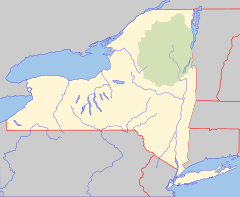
Cayadutta Creek is a river in Fulton and Montgomery counties in the state of New York. It begins northwest of Gloversville and flows in a general southward direction before flowing into the Mohawk River in Fonda. The Indian meaning of Cayadutta is "rippling waters" or "shallow water running over stones". This stream has commercial and historical importance as the cities of Johnstown and Gloversville lie on its banks.[3]
| Cayadutta Creek | |
|---|---|
| Location | |
| Country | United States |
| State | New York |
| Counties | Fulton, Montgomery |
| Physical characteristics | |
| Source | |
| • location | Northwest of Gloversville |
| • coordinates | 43°04′57″N 74°24′05″W / 43.0825722°N 74.4015263°W[1] |
| • elevation | Approximately 1,440 ft (440 m) |
| Mouth | Mohawk River |
• location | Fonda |
• coordinates | 42°57′02″N 74°22′49″W / 42.95056°N 74.38028°W[1] |
• elevation | 275 ft (84 m)[1] |
| Basin size | 63.7 sq mi (165 km2)[2] |
Geology
editThe Cayadutta Creek, or some similarly located stream, was one of the ancient watercourses which drained the southern Adirondack slopes.[4]
References
edit- ^ a b c "Cayadutta Creek". Geographic Names Information System. United States Geological Survey, United States Department of the Interior. Retrieved August 18, 2021.
- ^ "USGS 0134952405 Cayadutta Creek At Mouth At Fonda NY". usgs.gov. United States Geological Survey. Retrieved April 19, 2017.
- ^ "Fonda fultonville". Schenectadyhistory.org. Schenectady History. 1995. Retrieved April 19, 2017.
- ^ "Fonda fultonville". Schenectadyhistory.org. svhenectady history. 1995. Retrieved 19 April 2017.
data

