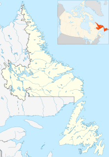
Cartwright Airport (IATA: YRF, ICAO: CYCA) is 1.5 nautical miles (2.8 km; 1.7 mi) southwest of Cartwright, Newfoundland and Labrador, Canada.
Cartwright Airport | |||||||||||
|---|---|---|---|---|---|---|---|---|---|---|---|
| Summary | |||||||||||
| Airport type | Public | ||||||||||
| Operator | Government of Newfoundland and Labrador | ||||||||||
| Location | Cartwright, Newfoundland and Labrador | ||||||||||
| Time zone | AST (UTC−04:00) | ||||||||||
| • Summer (DST) | ADT (UTC−03:00) | ||||||||||
| Elevation AMSL | 42 ft / 13 m | ||||||||||
| Coordinates | 53°40′57″N 057°02′31″W / 53.68250°N 57.04194°W | ||||||||||
| Map | |||||||||||
 | |||||||||||
| Runways | |||||||||||
| |||||||||||
As of March 2017, Cartwright is not listed as a scheduled destination in the Air Labrador flight schedule.[3]
References
edit- ^ Canada Flight Supplement. Effective 0901Z 16 July 2020 to 0901Z 10 September 2020.
- ^ Synoptic/Metstat Station Information Archived December 1, 2011, at the Wayback Machine
- ^ "Air Labrador Route Map". Archived from the original on 2017-03-02. Retrieved 2017-03-01.
External links
edit- Cartwright Airport on COPA's Places to Fly airport directory
- Accident history for YRF: Cartwright Airport at Aviation Safety Network
- Past three hours METARs, SPECI and current TAFs for Cartwright Airport from Nav Canada as available.
