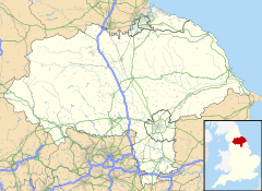
Carperby is a village in the Yorkshire Dales, North Yorkshire, England. It lies 7 miles (11 km) west of Leyburn.[1]
Etymology
editThe derivation of the villages name is uncertain, but Ekwall believes it to mean 'Cairpe's settlement' in Old Norse (Cairpes bȳ).[2] The name Cairpe is of Old Irish origin,[3][4] implying Norse-Gaelic settlement in the area.[4]
History
editIn the centre of the village is a Carperby Market Cross, dated 1674, that tells of the time when Carperby had a market (granted in 1305).[5] In the 17th century the village was an important Wensleydale centre of Quakerism, and its biggest building even today is the classically styled Carperby Quaker Meeting House of 1864.[6] In 1810, the western end of the village supposedly suffered from a fire which destroyed 12 thatched cottages. Whilst there is no documentary evidence of this, it is a locally believed legend and mapping from 1819 and 1856 does show at least nine dwellings as having been removed.[7][8]
The Richmond to Lancaster Turnpike was opened up through the village in 1751.[9][10] Later diversions meant that the main A684 road was diverted to run through Aysgarth. The minor road that now runs through Carperby shadows the A684 westwards along the valley until the two roads meet at Hardraw. The road through Carperby is colloquially known as 'The High Road'.[11] The name of the Wheatsheaf Hotel suggests a corn-growing past, and the inn itself was where James Herriot and his bride spent their honeymoon in 1941.[12]
In 2004, the village launched a campaign to provide a sports pavilion for its football team which plays in the Wensleydale Creamery League. After years of events and fundraising, the effort was still far short of its goal when the Mars confectionery company donated money to the final £125,000 needed to construct the pavilion. The building of the pavilion was filmed in a time-lapse and used by Mars as a TV advertisement which also had footballer Peter Crouch playing on the pitch at Carperby.[13][14]
References
edit- ^ "OL30" (Map). Yorkshire Dales - Northern & Central Area. 1;25,000. Explorer. Ordnance Survey. 2016. ISBN 9780319263358.
- ^ Ekwall, Eilert (1960). The concise Oxford dictionary of English place-names (4 ed.). Oxford: Clarendon Press. p. 88. ISBN 0-19-869103-3.
- ^ "Place names of the Yorkshire Dales". DalesNet. Retrieved 5 January 2019.
- ^ a b Stenton, Frank Merry (1970). Preparatory to Anglo-Saxon England: The Collected Papers of Frank Merry Stenton. Clarendon. p. 312. ISBN 0198223145. Retrieved 5 January 2019.
- ^ Historic England. "Carperby market cross (Grade II) (1014004)". National Heritage List for England. Retrieved 20 October 2017.
- ^ Historic England. "Friends Meeting House (Grade II) (1166479)". National Heritage List for England. Retrieved 20 October 2017.
- ^ White, William (1840). History, gazetteer, and directory, of the East and North Ridings of Yorkshire. Sheffield: William White. p. 607. OCLC 319907952.
- ^ "Out of Oblivion: A landscape through time". www.outofoblivion.org.uk. Retrieved 20 October 2017.
- ^ Speakman, Colin (5 November 2015). "Craven's turnpike history should be protected". Craven Herald. Retrieved 20 October 2017.
- ^ "Out of Oblivion: A landscape through time". www.outofoblivion.org.uk. Retrieved 20 October 2017.
- ^ "Genuki: In 1822, the following places were in the Parish of Aysgarth:, Yorkshire (North Riding)". www.genuki.org.uk. Retrieved 20 October 2017.
- ^ "James Herriot". The World of James Herriot. Hambleton District Council. Archived from the original on 19 July 2011. Retrieved 15 July 2010.
- ^ Sutcliffe, Robert (25 October 2010). "Carperby to get new sports pavilion – and starring role on TV – thanks to confectionery giant". The Yorkshire Post. Retrieved 20 October 2017.
- ^ Willis, Joe (10 February 2011). "Carperby famous for its football as TV advert goes live". The Northern Echo. Retrieved 20 October 2017.

