About half of the Camas National Wildlife Refuge in southeastern Idaho consists of lakes, ponds, and marshlands; the remainder is grass sagebrush uplands, meadows, and farm fields. Camas Creek flows through the length of the refuge.
| Camas National Wildlife Refuge | |
|---|---|
IUCN category IV (habitat/species management area) | |
 | |
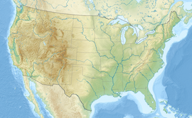
Map of the United States | |
| Location | Jefferson County, Idaho, United States |
| Nearest city | Hamer, Idaho |
| Coordinates | 43°57′05″N 112°14′57″W / 43.95129°N 112.24914°W[1] |
| Area | 10,578 acres (42.81 km2) |
| Established | 1937 |
| Governing body | U.S. Fish and Wildlife Service |
| Website | Camas National Wildlife Refuge |
Mammal species that inhabit this refuge are coyote, pronghorn, moose, elk, porcupine, white-tailed deer, cottontail rabbit, muskrat, and weasel.
Water management is a critical component of Camas Refuge operations. An extensive system of canals, dikes, wells, ponds, and water-control structures is used to manipulate water for the benefit of wildlife, with an emphasis on nesting waterfowl. Haying and prescribed fire are used to manipulate vegetation in some fields, and small grain crops are grown to provide supplemental feed for geese and cranes and to keep them from damaging private croplands.
Geography
editThe refuge has a surface area of 10,578 acres (42.81 km2).[2]
Climate
editAccording to the Köppen Climate Classification system, Camas National Wildlife Refuge has a cold semi-arid climate, abbreviated "BSk" on climate maps. The hottest temperature recorded at the weather station in Hamer was 105 °F (40.6 °C) on July 20, 1960 and August 12, 1990, while the coldest temperature recorded was −48 °F (−44.4 °C) on January 1, 1979.[3]
| Climate data for Hamer, Idaho, 1991–2020 normals, extremes 1948–present | |||||||||||||
|---|---|---|---|---|---|---|---|---|---|---|---|---|---|
| Month | Jan | Feb | Mar | Apr | May | Jun | Jul | Aug | Sep | Oct | Nov | Dec | Year |
| Record high °F (°C) | 55 (13) |
58 (14) |
74 (23) |
86 (30) |
93 (34) |
102 (39) |
105 (41) |
105 (41) |
99 (37) |
88 (31) |
70 (21) |
60 (16) |
105 (41) |
| Mean maximum °F (°C) | 40.9 (4.9) |
46.3 (7.9) |
63.3 (17.4) |
76.0 (24.4) |
84.3 (29.1) |
90.7 (32.6) |
96.3 (35.7) |
95.5 (35.3) |
89.5 (31.9) |
77.5 (25.3) |
59.5 (15.3) |
44.4 (6.9) |
97.2 (36.2) |
| Mean daily maximum °F (°C) | 29.2 (−1.6) |
35.5 (1.9) |
48.9 (9.4) |
60.4 (15.8) |
70.0 (21.1) |
78.9 (26.1) |
88.7 (31.5) |
87.4 (30.8) |
77.5 (25.3) |
61.6 (16.4) |
43.8 (6.6) |
30.1 (−1.1) |
59.3 (15.2) |
| Daily mean °F (°C) | 18.1 (−7.7) |
23.4 (−4.8) |
35.3 (1.8) |
44.7 (7.1) |
53.6 (12.0) |
61.4 (16.3) |
68.9 (20.5) |
67.3 (19.6) |
58.2 (14.6) |
45.0 (7.2) |
30.5 (−0.8) |
19.6 (−6.9) |
43.8 (6.6) |
| Mean daily minimum °F (°C) | 6.9 (−13.9) |
11.3 (−11.5) |
21.7 (−5.7) |
28.9 (−1.7) |
37.2 (2.9) |
43.9 (6.6) |
49.2 (9.6) |
47.1 (8.4) |
38.9 (3.8) |
28.4 (−2.0) |
17.3 (−8.2) |
9.2 (−12.7) |
28.3 (−2.0) |
| Mean minimum °F (°C) | −17.9 (−27.7) |
−11.6 (−24.2) |
3.3 (−15.9) |
13.6 (−10.2) |
22.8 (−5.1) |
31.0 (−0.6) |
38.5 (3.6) |
35.8 (2.1) |
25.2 (−3.8) |
11.6 (−11.3) |
−2.5 (−19.2) |
−15.1 (−26.2) |
−23.0 (−30.6) |
| Record low °F (°C) | −48 (−44) |
−46 (−43) |
−27 (−33) |
1 (−17) |
14 (−10) |
25 (−4) |
28 (−2) |
20 (−7) |
8 (−13) |
−8 (−22) |
−38 (−39) |
−40 (−40) |
−48 (−44) |
| Average precipitation inches (mm) | 0.72 (18) |
0.44 (11) |
0.50 (13) |
0.94 (24) |
1.47 (37) |
1.11 (28) |
0.52 (13) |
0.51 (13) |
0.63 (16) |
0.73 (19) |
0.56 (14) |
0.80 (20) |
8.93 (226) |
| Average snowfall inches (cm) | 5.8 (15) |
3.5 (8.9) |
1.7 (4.3) |
0.8 (2.0) |
0.0 (0.0) |
0.0 (0.0) |
0.0 (0.0) |
0.0 (0.0) |
0.0 (0.0) |
0.1 (0.25) |
1.7 (4.3) |
6.8 (17) |
20.4 (51.75) |
| Average precipitation days (≥ 0.01 in) | 6.3 | 4.9 | 4.0 | 6.3 | 7.3 | 5.9 | 3.5 | 3.7 | 3.9 | 4.3 | 4.5 | 6.4 | 61.0 |
| Average snowy days (≥ 0.1 in) | 5.0 | 3.3 | 0.8 | 0.4 | 0.0 | 0.0 | 0.0 | 0.0 | 0.0 | 0.2 | 1.7 | 4.7 | 16.1 |
| Source 1: NOAA[4] | |||||||||||||
| Source 2: National Weather Service[3] | |||||||||||||
Bird habitat
editDuring migration, which peaks in March–April and October, up to 50,000 ducks and 3,000 geese may be present on the refuge. Tundra and trumpeter swans visit in the hundreds during migration. Short-eared owls and long-billed curlews are commonly seen in this refuge. It has become a popular swan watching destination with hundreds of tundra and trumpeter swans stopping over during migration. Several state record songbird observations have been made in refuge cottonwood groves on the refuge.
References
edit- ^ "Camas National Wildlife Refuge". Geographic Names Information System. United States Geological Survey, United States Department of the Interior.
- ^ USFWS Annual Lands Report, 30 September 2007
- ^ a b "NOAA Online Weather Data – NWS Pocatello". National Weather Service. Retrieved June 16, 2023.
- ^ "U.S. Climate Normals Quick Access – Station: Hamer 4 NW, ID". National Oceanic and Atmospheric Administration. Retrieved June 16, 2023.
This article incorporates public domain material from websites or documents of the United States Fish and Wildlife Service.
