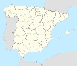
Calzada del Coto (Spanish pronunciation: [kalˈθaða ðel ˈkoto]) is a municipality located in the province of León, Castile and León, Spain. According to the 2023 census (INE), the municipality has a population of 222 inhabitants.
Calzada del Coto | |
|---|---|
 Saint Stephen Calzada del Coto Church | |
| Coordinates: 42°23′15″N 5°4′50″W / 42.38750°N 5.08056°W | |
| Country | Spain |
| Autonomous community | Castile and León |
| Province | León |
| Municipality | Calzada del Coto |
| Government | |
| • Mayor | Pablo Carbajal Carbajal (PP) |
| Area | |
• Total | 56.03 km2 (21.63 sq mi) |
| Elevation | 818 m (2,684 ft) |
| Population (2023)[1] | |
• Total | 222 |
| • Density | 4.0/km2 (10/sq mi) |
| Demonym(s) | cuqueto, cuqueta |
| Time zone | UTC+1 (CET) |
| • Summer (DST) | UTC+2 (CEST) |
| Postal Code | 24342 |
| Telephone prefix | 987 |
| Climate | Cfb |
| Website | Ayto. de Calzada del Coto |
The municipality of Calzada del Coto is made up of two towns: Calzada del Coto (seat or capital) and Codornillos.
Calzada del Coto is crossed by the Saint James Way, specifically by the French Way. 5 kilometers precede it from Sahagún. Once in Calzada, pilgrims can choose follow the Camino Real (Royal Road) to Bercianos del Real Camino or continue across the Calzada Romana (Roman Road) towards Calzadilla de los Hermanillos.
Demographics
editAccording to the 2023 census (INE), the municipality has a current population of 222. The population density was 4.0 people per km2 (10.0/sq mi).
| Year | Pop. | ±% p.a. |
|---|---|---|
| 1857 | 707 | — |
| 1860 | 595 | −5.59% |
| 1877 | 743 | +1.32% |
| 1887 | 739 | −0.05% |
| 1897 | 747 | +0.11% |
| 1900 | 784 | +1.62% |
| 1910 | 849 | +0.80% |
| 1920 | 752 | −1.21% |
| 1930 | 827 | +0.96% |
| 1940 | 939 | +1.28% |
| 1950 | 858 | −0.90% |
| 1960 | 825 | −0.39% |
| 1970 | 594 | −3.23% |
| 1981 | 440 | −2.69% |
| 1991 | 347 | −2.35% |
| 2001 | 293 | −1.68% |
| 2011 | 255 | −1.38% |
| 2021 | 218 | −1.56% |
| Instituto Nacional de Estadística | ||
References
edit- ^ Municipal Register of Spain 2018. National Statistics Institute.
