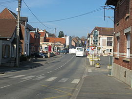
Bucquoy (French pronunciation: [bykwa]) is a commune in the Pas-de-Calais department in the Hauts-de-France region in northern France.[3]
Bucquoy | |
|---|---|
 The centre of Bucquoy | |
| Coordinates: 50°08′27″N 2°42′34″E / 50.1408°N 2.7094°E | |
| Country | France |
| Region | Hauts-de-France |
| Department | Pas-de-Calais |
| Arrondissement | Arras |
| Canton | Bapaume |
| Intercommunality | CC Sud-Artois |
| Government | |
| • Mayor (2020–2026) | Anne-Marie Barbier[1] |
Area 1 | 20.8 km2 (8.0 sq mi) |
| Population (2021)[2] | 1,480 |
| • Density | 71/km2 (180/sq mi) |
| Time zone | UTC+01:00 (CET) |
| • Summer (DST) | UTC+02:00 (CEST) |
| INSEE/Postal code | 62181 /62116 |
| Elevation | 105–154 m (344–505 ft) (avg. 124 m or 407 ft) |
| 1 French Land Register data, which excludes lakes, ponds, glaciers > 1 km2 (0.386 sq mi or 247 acres) and river estuaries. | |
The grounds, property of the Lords of Bucquoy, became a county in 1666 by request of Charles II.
Geography
editA farming village located 12 miles (19 km) south of Arras on the D919 road, at the junction with the D8.
Population
edit| Year | Pop. | ±% p.a. |
|---|---|---|
| 1968 | 1,344 | — |
| 1975 | 1,307 | −0.40% |
| 1982 | 1,253 | −0.60% |
| 1990 | 1,243 | −0.10% |
| 1999 | 1,218 | −0.23% |
| 2009 | 1,467 | +1.88% |
| 2014 | 1,512 | +0.61% |
| 2020 | 1,454 | −0.65% |
| Source: INSEE[4] | ||
Sights
edit- The church of St. Pierre, rebuilt, like most of the village, after destruction during World War I
- The ruins of a 13th-century château
- Queens Cemetery, for First World War allied casualties[5]
See also
editReferences
edit- ^ "Répertoire national des élus: les maires" (in French). data.gouv.fr, Plateforme ouverte des données publiques françaises. 13 September 2022.
- ^ "Populations légales 2021" (in French). The National Institute of Statistics and Economic Studies. 28 December 2023.
- ^ INSEE commune file
- ^ Population en historique depuis 1968, INSEE
- ^ Queens Cemetery, Commonwealth War Graves Commission
External links
editWikimedia Commons has media related to Bucquoy.


