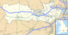
Brimpton (Wasing Lower Farm) Airfield is an unlicensed single-runway civilian airfield[1] in the south-east of West Berkshire, United Kingdom.
Brimpton (Wasing Lower Farm) Airfield | |||||||||||
|---|---|---|---|---|---|---|---|---|---|---|---|
| Summary | |||||||||||
| Airport type | Private | ||||||||||
| Owner | Brimpton Airfield LTD | ||||||||||
| Operator | Robin Greatrex | ||||||||||
| Location | Wasing | ||||||||||
| Elevation AMSL | 210 ft / 64 m | ||||||||||
| Coordinates | 51°23′02″N 001°10′09″W / 51.38389°N 1.16917°W | ||||||||||
| Website | www.brimpton-airfield.co.uk | ||||||||||
| Map | |||||||||||
 | |||||||||||
| Runways | |||||||||||
| |||||||||||
History
editClose to RAF Greenham Common, the airfield was founded in the 1950s by Sir William Mount, a director at Miles Aircraft in Woodley, Berkshire. In the 1970s, the airfield was used by crop spraying contractors for local agriculture until 1979 when it was designated for public civilian use.
In the early 2000s, the strip was expanded with a taxiway and aircraft hangars. The runway was extended to 620 metres (2,030 ft).
Location
editBrimpton Airfield is due south of a point equidistant between the Berkshire towns of Reading and Newbury, in the gently ascending fields south of the A4 road. Due to the airfield's close proximity to the Atomic Weapons Establishment in nearby Aldermaston, an R101(2.4) restriction is in place for the surrounding airspace, requiring all circuits to be completed to the north of the runway. Within the R101 catchment, the airfield has special exemption from the Civil Aviation Authority of the United Kingdom (CAA).
Incidents
editOn 14 February 2009 a pilot sustained injury in crashing their microlight within the airfield's perimeter.[2] On 5 June 2016 a Tiger Moth crashed on takeoff and collided with 2 parked cars; a person on the ground was injured.[3]
References
edit- ^ Brimpton Airfield
- ^ "Pilot injured in airfield crash". BBC. 15 February 2009. Retrieved 18 February 2009.
- ^ "Woman hurt after Tiger Moth crash at Brimpton Airfield". BBC. 6 June 2016. Retrieved 6 June 2016.
