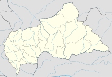
Bria Airport (IATA: BIV, ICAO: FEFR) is an airport serving Bria, a town on the Kotto River in the Haute-Kotto prefecture of the Central African Republic. The airport is in the southern section of the town.
Bria Airport | |||||||||||
|---|---|---|---|---|---|---|---|---|---|---|---|
| Summary | |||||||||||
| Airport type | Public | ||||||||||
| Serves | Bria, Central African Republic | ||||||||||
| Elevation AMSL | 1,916 ft / 584 m | ||||||||||
| Coordinates | 6°31′45″N 21°59′20″E / 6.52917°N 21.98889°E | ||||||||||
| Map | |||||||||||
 | |||||||||||
| Runways | |||||||||||
| |||||||||||
See also
editReferences
edit- ^ Airport record for Bria Airport at Landings.com. Retrieved 2013-08-25
- ^ "location of Bria Airport" (Map). Google Maps. Retrieved 2013-08-25.
- ^ Airport information for Bria Airport at Great Circle Mapper.
- ^ "Bria VOR (IA) @ OurAirports". ourairports.com. Retrieved 2018-08-20.
External links
edit
