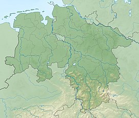
The Breitentalskopf is a hill in the Harz Mountains of central Germany, that rises southeast of Sieber in the district of Göttingen in Lower Saxony. It is 579.1 m high and separates the River Sieber from the Breitental valley (with its stream, the Tiefenbeek), that gave the hill its name. Towards the southeast is the ridge of the Aschentalshalbe.
| Breitentalskopf | |
|---|---|
| Highest point | |
| Elevation | 579.1 m (1,900 ft) |
| Prominence | 39 m ↓ Gropenborn |
| Isolation | 1,365 km → Gropenbornskopf |
| Coordinates | 51°41′36″N 10°25′51″E / 51.69333°N 10.43083°E |
| Geography | |
| Location | southeast of Sieber in Göttingen district in Lower Saxony, |
| Parent range | Harz Mountains |
Sources
edit- Topographic map 1:25000, No. 4328 Bad Lauterberg in Harz
