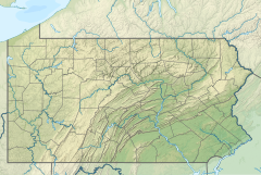
Bolivar Run is a 4.70 mi (7.56 km) long second-order tributary to Tunungwant Creek.[2]
| Bolivar Run Tributary to Tunungwant Creek | |
|---|---|
| Location | |
| Country | United States |
| State | Pennsylvania |
| County | McKean (PA) Cattaraugus (NY) |
| Physical characteristics | |
| Source | Bennett Branch divide |
| • location | about 4 miles northwest of Bradford, Pennsylvania |
| • coordinates | 42°00′7.23″N 078°41′44.11″W / 42.0020083°N 78.6955861°W[1] |
| • elevation | 2,190 ft (670 m)[1] |
| Mouth | Tunungwant Creek |
• location | northside of Bradford, Pennsylvania |
• coordinates | 41°58′24.23″N 078°37′29.10″W / 41.9733972°N 78.6247500°W[1] |
• elevation | 1,421 ft (433 m)[1] |
| Length | 4.70 mi (7.56 km)[2] |
| Basin size | 5.42 square miles (14.0 km2)[3] |
| Discharge | |
| • location | Tunungwant Creek |
| • average | 10.95 cu ft/s (0.310 m3/s) at mouth with Tunungwant Creek[3] |
| Basin features | |
| Progression | Tunungwant Creek → Allegheny River → Ohio River → Mississippi River → Gulf of Mexico |
| River system | Allegheny River |
| Tributaries | |
| • left | unnamed tributaries |
| • right | unnamed tributaries |
| Bridges | Bolivar Drive, Cross Drive, Bolivar Drive, Downing Drive, Colonial Heights Drive, Bigley Avenue, Seaward Avenue, US 219 |
Course
editBolivar Run rises about 4 miles (6.4 km) northwest of Bradford, Pennsylvania, and then flows southeast to meet Tunungwant Creek on the northside of Bradford, Pennsylvania.
Watershed
editBolivar Run drains 5.42 square miles (14.0 km2) of area, receives about 45.4 in/year (115 cm/year) of precipitation, and is about 87.36% forested.[3]
See also
editReferences
edit- ^ a b c d "Geographic Names Information System". edits.nationalmap.gov. US Geological Survey. Retrieved January 18, 2023.
- ^ a b "ArcGIS Web Application". epa.maps.arcgis.com. US EPA. Retrieved January 18, 2023.
- ^ a b c "Watershed Report | Office of Water | US EPA". watersgeo.epa.gov. US EPA. Retrieved January 18, 2023.

