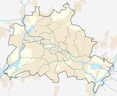
S-Bhf. Berlin Feuerbachstraße is a railway station in the Steglitz locality of Berlin, Germany. It is served by the Berlin S-Bahn and several local bus lines.
| Hp | |||||||||||
 | |||||||||||
| General information | |||||||||||
| Location | Steglitz-Zehlendorf, Berlin, Berlin Germany | ||||||||||
| Other information | |||||||||||
| Station code | 1787 | ||||||||||
| DS100 code | BFB | ||||||||||
| Category | 4 | ||||||||||
| Fare zone | VBB: Berlin B/5656[1] | ||||||||||
| History | |||||||||||
| Opened | 15 May 1933 | ||||||||||
| Services | |||||||||||
| |||||||||||
| |||||||||||
The station was opened on 15 May 1933 as part of the electrification of the Wannseebahn suburban line. It is 900 metres (980 yd) away from Berlin-Friedenau station and 1.1 kilometres (1,200 yd) away from Steglitz station.[2]
When the Berliner Verkehrsbetriebe (BVG) took over the operation of the station in January 1984, the station building was so dilapidated that they had to dismantle the station down to the steel frame and rebuild it.[3]
External links
editWikimedia Commons has media related to Bahnhof Berlin Feuerbachstraße.
- Station information (in German)
References
edit- ^ "Der VBB-Tarif: Aufteilung des Verbundgebietes in Tarifwaben und Tarifbereiche" (PDF). Verkehrsbetrieb Potsdam. Verkehrsverbund Berlin-Brandenburg. 1 January 2017. Archived from the original (PDF) on 27 October 2020. Retrieved 25 November 2019.
- ^ "Eröffnung von Bahnhöfen - Bezirk der RBD Berlin". Verschiedene Mitteilungen ("various announcements"). Die Reichsbahn. 9 (20). Berlin: Hauptverwaltung der Deutschen Reichsbahngesellschaft. May 17, 1933.
- ^ Dittfurth, Udo; Braun, Michael (2004). Berliner S-Bahn Museum (ed.). Die elektrische Wannseebahn: Zeitreisen mit der Berliner S-Bahn durch Schöneberg, Steglitz und Zehlendorf (in German) (1 ed.). Berlin: Gesellschaft für Verkehrspolitik und Eisenbahnwesen. p. 56. ISBN 3892180857.
52°27′49″N 13°19′58″E / 52.46361°N 13.33278°E


