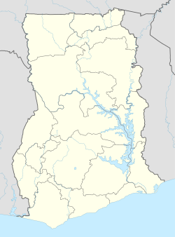
Berekum East Municipal District is one of the twelve districts in Bono Region, Ghana.[2][3] Originally it was formerly part of the then-larger Berekum District on 10 March 1989, which was created from the former Berekum-Jaman District Council. It was later upgraded to municipal district assembly status and has been renamed as Berekum Municipal District on 29 February 2008; until the western part of the district was split off to create Berekum West District on 15 March 2018; thus the remaining part has been renamed as Berekum East Municipal District. The municipality is located in the western part of Bono Region and has Berekum as its capital town.[4]
Berekum East Municipal District
District Municipal de Berekum-Est | |
|---|---|
Municipal District | |
| Nickname: Golden City (French: Ville d'Or) | |
 Districts of Bono Region | |
Location of Berekum East Municipal District within Bono Region | |
| Coordinates: 7°27′N 2°35′W / 7.450°N 2.583°W | |
| Country | |
| Region | Bono Region |
| Capital | Berekum |
| Government | |
| • Municipal Chief Executive | Mr. Kofi Agyei |
| Area | |
• Total | 955 km2 (369 sq mi) |
| Population (2021) | |
• Total | 106,252 [1] |
| Time zone | UTC+0 (GMT) |
| Website | Berekum East Municipal District Official Website |
List of settlements
edit| Settlements of Berekum East Municipal District | |||
| No. | Settlement | Population | Population year |
|---|---|---|---|
| 1 | Abisaase | ||
| 2 | Adom | ||
| 3 | Akroforo | ||
| 4 | Amomaso | ||
| 5 | Anyimon | ||
| 6 | Benkasa | ||
| 7 | Benkasem | ||
| 8 | Berekum | 60,473 | 2012 |
| 9 | Biadan | ||
| 10 | Botokrom | ||
| 11 | Domfete | ||
| 12 | Fetentaa | ||
| 13 | Jamdede | ||
| 14 | Jinijini | ||
| 15 | Kato | ||
| 16 | Koraso | ||
| 17 | Kutre No. 1 & 2 | ||
| 18 | Mpatapo | ||
| 19 | Mpatasie | ||
| 20 | Namasua | ||
| 21 | Nansuano | ||
| 22 | Nsapor | ||
| 23 | Oforikrom | ||
| 24 | Senase | ||
Sources
editReferences
edit- ^ "Ghana Statistical Services".
- ^ District: Berekum Municipal Archived March 23, 2012, at the Wayback Machine
- ^ "Brong Ahafo to be known as Bono Region". Graphic Online. Retrieved 2020-08-13.
- ^ "berekum.ghanadistricts.gov.gh". Berekum GhanaDistricts. Retrieved 2020-05-27.
