This article needs additional citations for verification. (December 2021) |
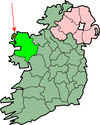
Belmullet Aerodrome is located 2 nautical miles (4 km; 2 mi) west of Belmullet (Irish: Béal an Mhuirthead), a town in County Mayo (Contae Mhaigh Eo), Ireland. The aerodrome, licensed by the Aeronautical Services Department of the Irish Aviation Authority,[1] is located at an elevation of 150 feet (46 m) above mean sea level. It has one runway designated 07/25 with a grass surface measuring 450 by 18 m (1,476 by 59 ft);[1] the airfield is part of the community sports ground.[citation needed]
Belmullet Aerodrome | |||||||||||
|---|---|---|---|---|---|---|---|---|---|---|---|
 Belmullet, County Mayo, Ireland | |||||||||||
| Summary | |||||||||||
| Airport type | Private | ||||||||||
| Operator | Comhar Iorrais Teo | ||||||||||
| Serves | Belmullet, Ireland | ||||||||||
| Elevation AMSL | 150 ft / 46 m | ||||||||||
| Coordinates | 54°13′22″N 010°01′51″W / 54.22278°N 10.03083°W | ||||||||||
 | |||||||||||
| Runways | |||||||||||
| |||||||||||
References
edit- ^ a b c Aerodrome Information - VFR Aerodromes and Heliports Archived 15 June 2011 at the Wayback Machine. Aeronautical Information Service of the Irish Aviation Authority. Effective 2008.
External links
edit