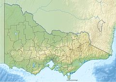
The Back River is a perennial river of the Mitchell River catchment, located in the Alpine region of the Australian state of Victoria.[3]
| Back | |
|---|---|
| Location | |
| Country | Australia |
| State | Victoria |
| Region | South East Corner (IBRA), Victorian Alps |
| Local government area | Shire of East Gippsland |
| Physical characteristics | |
| Source | Nunniong Plains, Great Dividing Range |
| • location | below Mount Bindi |
| • elevation | 1,380 m (4,530 ft) |
| Mouth | confluence with the Timbarra River |
• location | northeast of Ensay |
• coordinates | 37°13′24″S 147°58′17″E / 37.22333°S 147.97139°E |
• elevation | 796 m (2,612 ft) |
| Length | 11 km (6.8 mi) |
| Basin features | |
| River system | Mitchell River catchment |
| [1][2] | |
Course and features
editThe Back River rises on the Nunniong Plains, below Mount Bindi, that is part of the Great Dividing Range; in remote country east of Omeo.[3] The river flows generally east, then southeast, before reaching its confluence with the Timbarra River in a state forestry area, about 10 kilometres (6.2 mi) northeast of Ensay in the Shire of East Gippsland.[4][5] The river descends 588 metres (1,929 ft) over its 11 kilometres (6.8 mi) course.[2]
References
edit- ^ "Back River: 9696". Vicnames. Government of Victoria. 2 May 1966. Archived from the original on 14 January 2014. Retrieved 13 January 2014.
- ^ a b "Map of Back River, VIC". Bonzle Digital Atlas of Australia. Retrieved 13 January 2014.
- ^ a b 8423 Omeo, Victoria, Topographic Map (Map) (1 ed.). National Topographic Map Series. Commonwealth of Australia. 1982.
- ^ Vicroads Country Street Directory of Victoria (4 ed.). Noble Park, Victoria: Royal Automobile Club of Victoria. 2000. ISSN 1329-5284.
- ^ "Timbarra River - Tambo Nicholson Catchment". East Gippsland Directories. G.W. & L.A. Keating. Retrieved 21 May 2009.
External links
edit- "Tambo River sub-catchment". East Gippsland Catchment Management Authority. Government of Victoria.
- "Tambo River - Catchment Map" (map). East Gippsland Catchment Management Authority. Government of Victoria.
- East Gippsland Catchment Management Authority (2013). East Gippsland regional catchment strategy 2013 -2019 (PDF). Bairnsdale: East Gippsland Catchment Management Authority. ISBN 978-0-9758164-6-2. Archived from the original (PDF) on 14 January 2014. Retrieved 13 January 2014.
