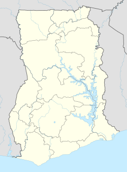
Atimpoku is a small town in the Eastern Region of Ghana and located along the Volta River. It is the capital of the Asuogyaman District, a district in the Eastern Region of Ghana.[1]
Atimpoku | |
|---|---|
 | |
Location of Atimpoku in Eastern Region, Ghana | |
| Coordinates: 6°13′51″N 0°5′29″W / 6.23083°N 0.09139°W | |
| Country | |
| Region | Eastern Region |
| District | Asuogyaman District |
| Elevation | 12 m (39 ft) |
| Time zone | GMT |
| • Summer (DST) | GMT |
Geography
editThis section needs additional citations for verification. (March 2021) |
The town of Atimpoku is located on the banks of the Volta River, which drains south to the Gulf of Guinea, and is the location of the Adomi Bridge (originally the Volta Bridge), Ghana's longest suspension bridge and the first permanent bridge to span the Volta River.[2][3] The town is about 2.5 miles downstream from Lake Volta and the Akosombo Dam, a hydroelectric facility which supplies electricity to Ghana and an electricity exporter to neighboring countries of Ghana.[1][4]
Atimpoku is about 87 km (54 mi) northeast of Accra, the capital of Ghana, and about 75 km (47 mi) north of the port of Tema[citation needed].
References
edit- ^ a b "Asuogyaman District". Archived from the original on 2022-11-28. Retrieved 2012-12-26.
- ^ Scott, Peter Adamson; Roberts, Gilbert. "The Volta Bridge". Institute of Civil Engineers Virtual Library. Proceedings of the Institution of Civil Engineers, E-ISSN 1753-7789, Volume 9, Issue 4, April 1958, pp. 395-432. Retrieved 2 August 2020.
- ^ "Danger on Adomi Bridge as portions of road develop pothole". Modern Ghana. 15 April 2023. Retrieved 27 November 2023.
- ^ "Dead male body found floating on the Volta Lake at Atimpoku". GhanaWeb. 2023-11-21. Retrieved 2023-11-27.
External links
edit- Ghana-pedia webpage - Atimpoku
- "Atimpoku, Ghana Enhanced Weather Satellite Map - AccuWeather.com". AccuWeather. Retrieved 2017-12-05.
