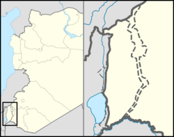
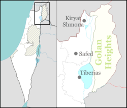
Alonei HaBashan (Hebrew: אַלּוֹנֵי הַבָּשָׁן) is an Israeli settlement located in the eastern Golan Heights, organized as a moshav shitufi,[2] under the administration of Israel. The settlement was established after Israel occupied the area in the Six Day War in 1967. It falls under the municipal jurisdiction of the Golan Regional Council, and is the easternmost locality within Israeli-controlled territory. In 2022 it had a population of 518.[1] It is part of the Hapoel HaMizrachi movement.[3]
Alonei HaBashan
אַלּוֹנֵי הַבָּשָׁן | |
|---|---|
| Hebrew transcription(s) | |
| • official | Allone HaBashan |
 | |
| Coordinates: 33°2′35″N 35°50′16″E / 33.04306°N 35.83778°E | |
| District | Northern |
| Council | Golan |
| Region | Golan Heights |
| Founded | 1981 |
| Population (2022)[1] | 518 |
The international community considers Israeli settlements in the Golan Heights illegal under international law, but the Israeli government disputes this.[4]
Etymology
The name, literally "Oaks of Bashan", is taken from the Bible (Isaiah 2:13). "Bashan" is a Biblical name for the Golan Heights.
History
The settler nucleus was established on the basis of a group of singles and one family who received settlement training at Ramat Magshimim.[5] The nucleus ascended to the site on Lag BaOmer, May 1981 and the moshav was established.[3][5] The nucleus of the founders included Bnei Akiva graduates[6] who wanted to emphasize the importance of settlement in all parts of Israel and especially in the sparsely populated center of the Golan.
Many times the moshav was encountered with water shortage.[5][7]
In November 2012, three mortars fired from Syrian-controlled territory landed near Alonei Bashan. Two exploded in open areas and one fell outside a house but did not explode.[8] In February 2013, a Syrian tank shell landed in the village. Sappers who dismantled it believe it may have been a stray round fired in the course of the Syrian Civil War.[9]
Geography
The settlement is located on the edge of the Bashanit ridge,[10] and as the easternmost settlement in Israeli-occupied territory,[5] it is located about 700 meters from the ceasefire line between Israel and Syria. The settlement is located at an altitude of 980 meters above sea level,[11] near Mount Hosek (which is 1158 meters high). The settlement is adjacent to a large nature reserve called "Forest Bashanit"[12][11] - the second largest natural forest in the Golan.
The height of the settlement above sea level affects the weather in the place. In the summer the weather is cool and pleasant during the day, and at night it is sometimes not enough with light clothing. In winter the weather is cold. The whole area is often covered with thick fog, strong winds blow and every year the settlement is covered with significant snow.[13][14]
Economy
The economy of the moshav is based on agriculture. This includes cherry,[15] apple,[16] and vine groves for wine production.[17][16] It has also a dairy farm.[16]
There are also tourist attractions: a horse riding farm[11] and a company that operates segway tours called "Kaal Daat - Segway trips".[12]
The moshav also has a unique high school yeshiva[18] that provides individual education and contains children with learning disabilities,[19] or those who prefer personal treatment and a family atmosphere. Each class has a limited number of students, who are given the opportunity to specialize in photography, film and cruising, as well as to take part in an equestrian center used for tourism and therapeutic riding and located at the entrance to the moshav.
See also
References
- ^ a b "Regional Statistics". Israel Central Bureau of Statistics. Retrieved 21 March 2024.
- ^ Kartin, Avi (1985-11-05). "סיוע קטן, צרות גדולות". Hadashot. Retrieved 2021-07-10.
- ^ a b Weiss, Shimon (1981-05-25). "מושב אלוני־הבשן עלה על הקרקע ברמת הגולן". Davar. Retrieved 2021-07-10.
- ^ "The Geneva Convention". BBC. 10 December 2009.
- ^ a b c d Weiss, Shimon (1981-06-09). "הישוב המזרחי ביותר". Hadashot. Retrieved 2021-07-10.
- ^ Weiss, Shimon (1981-07-14). "שלושה ישובים בגולן". Davar. Retrieved 2021-07-10.
- ^ Weiss, Shimon (1983-12-13). "מחסור במים באלוני הבשן בגולן". Davar. Retrieved 2021-07-10.
- ^ second time in a week, stray Syrian bullets hit IDF border post
- ^ Winer, Stuart (2013-05-20). "Golan Heights hit by stray bullets from Syria". The Times of Israel. Archived from the original on 2013-05-20. Retrieved 2021-07-10.
- ^ Sharabi, Meital (2019-11-07). "Tour Israel: Wild about flowers". The Jerusalem Post. Archived from the original on 2019-11-08. Retrieved 2021-07-10.
- ^ a b c Finkler, Kobi (2018-05-30). "טיול: שמורת אלוני הבשן". Arutz Sheva (in Hebrew). Archived from the original on 2021-07-10. Retrieved 2021-07-10.
- ^ a b "אלוני הבשן – בשטח יער בשנית". קל-דעת טיולי סגווי בשטח (in Hebrew). Retrieved 2021-07-10.
- ^ Weiss, Shimon (1983-03-22). "הווי חרפי בגולן". Davar. Retrieved 2021-07-10.
- ^ Raved, Ahiya (2016-01-01). "Snow falls on Mount Hermon and in Safed". Ynetnews. Retrieved 2021-07-10.
- ^ Rozen, Kobi (2021-06-20). "נעצרו בחשד לגניבת 161 ק"ג של דובדבנים". Kikar HaShabbat (in Hebrew). Archived from the original on 2021-06-22. Retrieved 2021-07-10.
- ^ a b c Saada, Dani (1987-08-07). "איגוד מושבי הפועל המזרחי". Maariv. Retrieved 2021-07-10.
- ^ Gat, Yair (2020-10-28). "התגנבות יחידניים: יינות חדשים מרמת הגולן". Maariv. Archived from the original on 2021-01-30. Retrieved 2021-07-10.
- ^ Chai, Shahar (2014-09-08). "התלמידים הכי ערכיים: "הצדעה של המדינה"". ynet (in Hebrew). Retrieved 2021-07-10.
- ^ Kelner, Gil (2016-08-02). "ראש ישיבת אלוני הבשן: "אצלנו אין נושרים. אנחנו לא מוותרים לאף תלמיד"". Srugim (in Hebrew). Archived from the original on 2016-08-03. Retrieved 2021-07-10.

