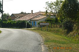
Allas-Bocage is a commune in Charente-Maritime, Nouvelle-Aquitaine, France.
Allas-Bocage | |
|---|---|
 The road into Allas-Bocage | |
| Coordinates: 45°23′02″N 0°29′31″W / 45.38389°N 0.49194°W | |
| Country | France |
| Region | Nouvelle-Aquitaine |
| Department | Charente-Maritime |
| Arrondissement | Jonzac |
| Canton | Jonzac |
| Intercommunality | Haute Saintonge |
| Government | |
| • Mayor (2020–2026) | Bernard Brossard[1] |
Area 1 | 10.87 km2 (4.20 sq mi) |
| Population (2022)[2] | 197 |
| • Density | 18/km2 (47/sq mi) |
| Time zone | UTC+01:00 (CET) |
| • Summer (DST) | UTC+02:00 (CEST) |
| INSEE/Postal code | 17005 /17150 |
| Elevation | 39–108 m (128–354 ft) |
| 1 French Land Register data, which excludes lakes, ponds, glaciers > 1 km2 (0.386 sq mi or 247 acres) and river estuaries. | |
Geography
editAllas-Bocage is located some 5 km north-east of Mirambeau and 40 km south by south-west of Cognac. It can be accessed by the minor D151 road running off the D730 in the south-west and continuing north-east through the commune to the village then north to Jonzac. The D153 road also goes from Nieul-le-Virouil in the north-west through the commune north of the village and continues to join the D19 highway in the east. The D50 road from Nieul-le-Virouil also passes through the western part of the commune going south to Soubran. There are three hamlets in the commune apart from the village: Le Pain, Le Maine-Neuf, and Berceleu. The commune is mostly farmland with forests along the eastern border.[3]
The Tarnac river forms the western border of the commune and an unnamed stream forms much of the southern border of the commune flowing west to join the Ruisseau de Fanioux to form the Tarnac river. The Etang d'Allas is an elongated lake which forms the north-eastern border of the commune and the stream that flows out of the lake forms the northern border before joining the Maine in the north.[3]
Administration
editList of Successive Mayors[4]
| From | To | Name | Party | Position |
|---|---|---|---|---|
| 2001 | 2014 | Paul Viel | DVG | Retired |
| 2014 | 2026 | Bernard Brossard | DVG |
Population
editThe inhabitants of the commune are known as Allasiens or Allasiennes in French.[5]
| Year | Pop. | ±% p.a. |
|---|---|---|
| 1968 | 186 | — |
| 1975 | 189 | +0.23% |
| 1982 | 173 | −1.26% |
| 1990 | 163 | −0.74% |
| 1999 | 150 | −0.92% |
| 2007 | 186 | +2.73% |
| 2012 | 211 | +2.55% |
| 2017 | 195 | −1.56% |
| Source: INSEE[6] | ||
Distribution of Age Groups
editPercentage Distribution of Age Groups in Allas-Bocage and Charente-Maritime Department in 2017
| Allas-Bocage | Charente-Maritime | |||
|---|---|---|---|---|
| Age Range | Men | Women | Men | Women |
| 0 to 14 Years | 14.6 | 11.0 | 16.3 | 14.3 |
| 15 to 29 Years | 11.5 | 19.0 | 15.4 | 13.1 |
| 30 to 44 Years | 16.7 | 20.0 | 16.7 | 16.1 |
| 45 to 59 Years | 25.0 | 20.0 | 20.2 | 19.9 |
| 60 to 74 Years | 18.7 | 18.0 | 21.1 | 22.0 |
| 75 to 89 Years | 12.5 | 12.0 | 9.4 | 12.3 |
| 90 Years+ | 1.0 | 0.0 | 1.0 | 2.4 |
Sites and Monuments
editThe Church of Saint Martin (12th century) is a Romanesque building that is registered as an historical monument.[8] It contains four items listed as historical monuments since 5 December 1908:
See also
editReferences
edit- ^ "Répertoire national des élus: les maires". data.gouv.fr, Plateforme ouverte des données publiques françaises (in French). 2 December 2020.
- ^ "Populations de référence 2022" (in French). The National Institute of Statistics and Economic Studies. 19 December 2024.
- ^ a b Google Maps
- ^ List of Mayors of France
- ^ Le nom des habitants du 17 - Charente-Maritime, habitants.fr
- ^ a b Évolution et structure de la population en 2017: Commune d'Allas-Bocage (17005)
- ^ Évolution et structure de la population en 2017: Département de la Charente-Maritime (17)
- ^ Ministry of Culture, Mérimée PA00104590 Church of Saint Martin (in French)
- ^ Ministry of Culture, Palissy PM17000008 Tombstone (in French)
- ^ Ministry of Culture, Palissy PM17000007 Bronze bell (in French)
- ^ Ministry of Culture, Palissy PM17000006 Stoup (in French)
- ^ Ministry of Culture, Palissy PM17000005 Baptismal font (in French)
External links
edit- Allas-Bocage on the old IGN website (in French)
- Allas-Bocage on Géoportail, National Geographic Institute (IGN) website (in French)
- Allas Boccage on the 1750 Cassini Map


