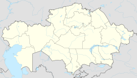
Aksuat (/ˌɑːksuˈɑːt/; Kazakh: Ақсуат / Aqsuat [ɑqsʊˈwɑt]; Russian: Аксуат, IPA: [əksʊˈat]) is a village in Aksuat District, Abai Region, Kazakhstan. It is the administrative center of the district. It had a population of 6,126 (2009 Census results);[1] 7,503 (1999 Census results).[1]
Aksuat
Ақсуат | |
|---|---|
 | |
| Coordinates: 47°45′43.95″N 82°48′5.85″E / 47.7622083°N 82.8016250°E | |
| Country | |
| Region | Abai Region |
| District | Aksuat District |
| Government | |
| • Type | Akimat |
| • Akim | Uvaliyev Toktar |
| Elevation | 1,781 ft (543 m) |
| Time zone | UTC+6 (+6) |
| Post code | 071500 -071515 |
| Area code | +7 72346 |
| Website | tarbagatay |
Toponymy
editThe name Aksuat derives from two Kazakh words: ақ (aq) "white" and суат (sýat) "pond".
History
editAksuat was part of Tarbagatay District of East Kazakhstan Region until 2022, when the Aksuat District of Abai Region was established.[2]
Climate
editExtreme continental. Winter is cold (in January average temperature – 22°С, – 30°С) and summer is hot (in July average temperature + 25°С, + 35°С). Very poor precipitation (200 – 300 mm/year) mostly in the winter season.[3]
| Climate data for Aksuat (1991–2020) | |||||||||||||
|---|---|---|---|---|---|---|---|---|---|---|---|---|---|
| Month | Jan | Feb | Mar | Apr | May | Jun | Jul | Aug | Sep | Oct | Nov | Dec | Year |
| Mean daily maximum °C (°F) | −13.1 (8.4) |
−9.3 (15.3) |
−0.2 (31.6) |
15.5 (59.9) |
22.7 (72.9) |
27.9 (82.2) |
29.4 (84.9) |
28.3 (82.9) |
21.8 (71.2) |
12.9 (55.2) |
0.0 (32.0) |
−9.4 (15.1) |
10.5 (50.9) |
| Daily mean °C (°F) | −18.4 (−1.1) |
−15.2 (4.6) |
−6.0 (21.2) |
8.0 (46.4) |
15.1 (59.2) |
20.6 (69.1) |
22.1 (71.8) |
20.6 (69.1) |
13.8 (56.8) |
5.4 (41.7) |
−5.6 (21.9) |
−14.5 (5.9) |
3.8 (38.8) |
| Mean daily minimum °C (°F) | −23.0 (−9.4) |
−20.3 (−4.5) |
−11.1 (12.0) |
1.2 (34.2) |
7.7 (45.9) |
13.5 (56.3) |
15.4 (59.7) |
13.4 (56.1) |
6.6 (43.9) |
−0.8 (30.6) |
−10.0 (14.0) |
−18.9 (−2.0) |
−2.2 (28.0) |
| Average precipitation mm (inches) | 9.9 (0.39) |
7.5 (0.30) |
10.3 (0.41) |
14.1 (0.56) |
22.0 (0.87) |
33.3 (1.31) |
39.5 (1.56) |
20.4 (0.80) |
14.2 (0.56) |
14.7 (0.58) |
15.2 (0.60) |
13.1 (0.52) |
214.2 (8.43) |
| Average precipitation days (≥ 1.0 mm) | 3.2 | 2.9 | 3.1 | 3.5 | 4.9 | 5.6 | 7.0 | 4.3 | 3.3 | 3.7 | 4.2 | 3.8 | 49.5 |
| Source: NOAA[4] | |||||||||||||
References
edit- ^ a b "Население Республики Казахстан" [Population of the Republic of Kazakhstan] (in Russian). Департамент социальной и демографической статистики. Retrieved 8 December 2013.
- ^ Правовые акты Указы - О некоторых вопросах административно-территориального устройства Республики Казахстан
- ^ [1] Archived February 21, 2008, at the Wayback Machine
- ^ "World Meteorological Organization Climate Normals for 1991-2020 — Aksuat". National Oceanic and Atmospheric Administration. Retrieved January 1, 2024.
External links
edit- Akim of Tarbagatay District Archived 2008-12-05 at the Wayback Machine
- www.geonames.de Subdivisions of Kazakhstan in local languages
