This article needs additional citations for verification. (May 2022) |
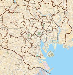
Yushima Station (湯島駅, Yushima-eki) is a subway station on the Tokyo Metro Chiyoda Line in the Bunkyo-ku, Tokyo, Japan, operated by the Tokyo subway operator Tokyo Metro. It is located near Shinobazu Pond and Ueno Park.
C13 Yushima Station 湯島駅 | |||||||||||
|---|---|---|---|---|---|---|---|---|---|---|---|
 Platform of Yushima Station | |||||||||||
| General information | |||||||||||
| Location | 3-47-10 Yushima, Bunkyō-ku, Tokyo Japan | ||||||||||
| Operated by | |||||||||||
| Line(s) | C Chiyoda Line | ||||||||||
| Platforms | 1 island platform | ||||||||||
| Tracks | 2 | ||||||||||
| Construction | |||||||||||
| Structure type | Underground | ||||||||||
| Other information | |||||||||||
| Station code | C-13 | ||||||||||
| History | |||||||||||
| Opened | 20 December 1969 | ||||||||||
| Services | |||||||||||
| |||||||||||
| |||||||||||
Lines
editYushima Station is served by the Tokyo Metro Chiyoda Line. Through services operate to and from the Odakyu Odawara Line to the south and the JR Joban Line to the north. It is also relatively close to Ueno-hirokoji Station on the Tokyo Metro Ginza Line and Ueno-Okachimachi Station on the Toei Ōedo Line (around 350 meters northeast), although it is not officially recognized as a transfer station and there is no transfer corridor between the three stations.
Station layout
editThe station consists of one island platform serving two tracks.
Platforms
edit| 1 | C Chiyoda Line | for Otemachi and Yoyogi-uehara Odakyu Odawara Line for Hon-Atsugi and Isehara |
| 2 | C Chiyoda Line | for Kita-senju, Ayase and Kita-ayase JL Jōban Line for Abiko and Toride |
History
editYushima Station opened on December 20, 1969.
The station facilities were inherited by Tokyo Metro after the privatization of the Teito Rapid Transit Authority (TRTA) in 2004.[1]
Surrounding area
edit- Shinobazu Pond and Ueno Park
- Ueno
- Akihabara
- Ueno-hirokoji Station, Suehirochō Station ( Tokyo Metro Ginza Line)
- Ueno-okachimachi Station ( Toei Ōedo Line)
- Yushima Tenmangu Shrine
References
edit- ^ "「営団地下鉄」から「東京メトロ」へ" [From "Teito Rapid Transit Authority" to "Tokyo Metro"]. Tokyo Metro Online (in Japanese). 8 July 2006. Archived from the original on 16 May 2012. Retrieved 29 May 2022.
35°42′29″N 139°46′12″E / 35.707954°N 139.769933°E


