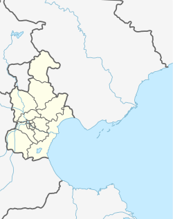
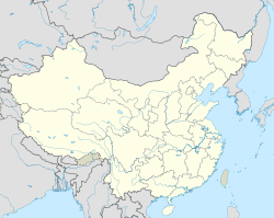
Xiangyang Road Subdistrict (simplified Chinese: 向阳路街道; traditional Chinese: 向陽路街道; pinyin: Xiàngyánglù Jiēdào) is a subdistrict situated on the northwestern corner of Nankai District, Tianjin, China. It borders Xiyingmen and Shaogongzhuang Subdistricts in the north, Changhong Subdistrict in the east, Jialing Avenue Subdistrict in the south, and Zhongbei Town in the west. As of 2010, 145,263 residents were counted for this su bdistrict.[1]
Xiangyang Road Subdistrict
向阳路街道 | |
|---|---|
 Location in Nankai District | |
| Coordinates: 39°08′16″N 117°07′29″E / 39.13778°N 117.12472°E | |
| Country | China |
| Municipality | Tianjin |
| District | Nankai |
| Village-level Divisions | 16 communities |
| Area | |
| • Total | 3.73 km2 (1.44 sq mi) |
| Elevation | 7 m (23 ft) |
| Population (2010) | |
| • Total | 145,263 |
| • Density | 39,000/km2 (100,000/sq mi) |
| Time zone | UTC+8 (China Standard) |
| Postal code | 300111 |
| Area code | 022 |
The subdistrict was formed in 1975 from part of Xiyingmenwai Subdistrict, and was named after Xiangyang Road (Chinese: 向阳路; lit. 'Facing Sun Road') under its administration in 1978.[2]
Geography
editXiangyang Road subdistrict situates on the south of Nanyun River. Part of Chentangzhuang Branch Railway passes through the subdistrict.
Administrative divisions
editBelow is a list of the 16 residential communities under Xiangyang Road Subdistrict by the end of 2021:[3]
| Subdivision Names | Name Transliterations |
|---|---|
| 向阳路 | Xiangyanglu |
| 云阳里 | Yunyangli |
| 华阳里 | Huayangli |
| 战备楼 | Zhanbeilou |
| 延安楼 | Yan'anlou |
| 芥园中里 | Jieyuan Zhongli |
| 冶金里 | Yejinli |
| 留园里 | Liuyuanli |
| 集园里 | Jiyuanli |
| 昔阳里 | Xiyangli |
| 延长里 | Yanchangli |
| 宜君里 | Yijunli |
| 大园新居 | Dayuan Xinju |
| 瑞湾花园 | Ruiwan Huayuan |
| 南泥湾路 | Nan Niwanlu |
| 南开区新南马路五金城商圈 | Nankaiqu Xin Nanmalu Wujincheng Shangquan |
References
edit- ^ "China: Tiānjīn Municipal Province (Districts and Townships) - Population Statistics, Charts and Map". www.citypopulation.de. Retrieved 2022-11-05.
- ^ 中华人民共和国政区大典:天津市卷 (in Chinese). 中国社会出版社. 2020.
- ^ "2021年统计用区划代码和城乡划分代码". www.stats.gov.cn. Retrieved 2022-11-21.

