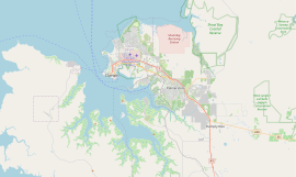
Wanguri is a northern suburb of the city of Darwin, Northern Territory, Australia. It is on the traditional Country and waterways of the Larrakia people.[2]
| Wanguri Darwin, Northern Territory | |||||||||||||||
|---|---|---|---|---|---|---|---|---|---|---|---|---|---|---|---|
 Casuarina Exchange located at Wanguri. | |||||||||||||||
 | |||||||||||||||
| Coordinates | 12°22′21″S 130°53′16″E / 12.37250°S 130.88778°E | ||||||||||||||
| Population | 1,876 (2016 census)[1] | ||||||||||||||
| • Density | 1,880/km2 (4,860/sq mi) | ||||||||||||||
| Established | 1972 | ||||||||||||||
| Postcode(s) | 0810 | ||||||||||||||
| Area | 1.0 km2 (0.4 sq mi) | ||||||||||||||
| Location | 13.8 km (9 mi) from Darwin | ||||||||||||||
| LGA(s) | City of Darwin | ||||||||||||||
| Territory electorate(s) | Wanguri | ||||||||||||||
| Federal division(s) | Solomon | ||||||||||||||
| |||||||||||||||
History
editWanguri was one of Darwin's northern suburbs built before Cyclone Tracy in 1974. It derives its name from a clan of the Dangu Aboriginal people, whose land is in east Arnhem Land, near Caledon Bay.[3] The streets in Wanguri are mostly named after early Greek residents of Darwin.
Present day
editMajor features of Wanguri include the Wanguri Primary School and Wanguri Park. Wanguri experienced a decrease in population between 1996 and 2001.
Wanguri is part of the Wanguri electoral division which also includes Leanyer, Muirhead and parts of Lyons.[4]
See also
editReferences
edit- ^ Australian Bureau of Statistics (27 June 2017). "Wanguri (State Suburb)". 2016 Census QuickStats. Retrieved 28 June 2017.
- ^ "The Larrakia People". Larrakia Nation. 31 March 2023. Retrieved 26 February 2024.
- ^ "Place Names Register Extract: Wanguri". NT Place Names Register. Northern Territory Government. Retrieved 13 February 2025.
- ^ "Division of Wanguri". Northern Territory Electoral Commission. Northern Territory Government. 2011. Retrieved 1 May 2015.
External links
editWikimedia Commons has media related to Wanguri, Northern Territory.
