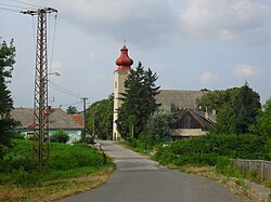
Vyškovce nad Ipľom (Hungarian: Ipolyvisk) is a village and municipality in the Levice District in the Nitra Region of Slovakia.
Vyškovce nad Ipľom
Ipolyvisk | |
|---|---|
 | |
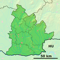
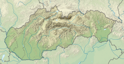
Location of Vyškovce nad Ipľom in the Nitra Region Location of Vyškovce nad Ipľom in Slovakia | |
| Coordinates: 48°03′N 18°52′E / 48.05°N 18.87°E | |
| Country | |
| Region | |
| District | Levice District |
| First mentioned | 1256 |
| Area | |
• Total | 19.30 km2 (7.45 sq mi) |
| Elevation | 140 m (460 ft) |
| Population (2021)[3] | |
• Total | 657 |
| Time zone | UTC+1 (CET) |
| • Summer (DST) | UTC+2 (CEST) |
| Postal code | 935 77[2] |
| Area code | +421 36[2] |
| Car plate | LV |
| Website | www |
History
editIn historical records the village was first mentioned in 1156, whilst the castle was mentioned first in 1296, when Andrew III of Hungary confiscated it from the sons of Jakab Cseszneky because of the disloyalty of the Csesznekys and donated the castle to János (Csák's son) of the clan Csák. Later the Koháry, Esterházy, Forgách, and Breuner families were the most important landlords in the village.
Geography
editThe village lies at an altitude of 123 metres and covers an area of 19.295 km2.
Ethnicity
editThe village is approximately 85% Magyar and 15% Slovak.[4][needs update]
Facilities
editThe village has a public library and football pitch.
References
edit- ^ "Hustota obyvateľstva - obce [om7014rr_ukaz: Rozloha (Štvorcový meter)]". www.statistics.sk (in Slovak). Statistical Office of the Slovak Republic. 2022-03-31. Retrieved 2022-03-31.
- ^ a b c "Základná charakteristika". www.statistics.sk (in Slovak). Statistical Office of the Slovak Republic. 2015-04-17. Retrieved 2022-03-31.
- ^ "Počet obyvateľov podľa pohlavia - obce (ročne)". www.statistics.sk (in Slovak). Statistical Office of the Slovak Republic. 2022-03-31. Retrieved 2022-03-31.
- ^ "Vyškovce nad Ipľom - Selected results of 1991 and 2001 census". Statistical Office of the Slovak Republic. Retrieved 23 October 2024.
External links
edit

