Všeruby (German: Neumark) is a market town in the Domažlice District in the Plzeň Region of the Czech Republic. It has about 800 inhabitants.
Všeruby | |
|---|---|
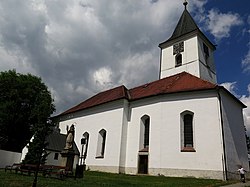
 Church of Saint Michael the Archangel | |
| Coordinates: 49°20′34″N 12°59′12″E / 49.34278°N 12.98667°E | |
| Country | |
| Region | Plzeň |
| District | Domažlice |
| First mentioned | 1570 |
| Area | |
• Total | 38.49 km2 (14.86 sq mi) |
| Elevation | 437 m (1,434 ft) |
| Population (2024-01-01)[1] | |
• Total | 795 |
| • Density | 21/km2 (53/sq mi) |
| Time zone | UTC+1 (CET) |
| • Summer (DST) | UTC+2 (CEST) |
| Postal code | 345 07 |
| Website | www |
Administrative parts
editThe villages of Brůdek, Chalupy, Hájek, Hyršov, Kosteliště, Maxov, Pláně, Pomezí and Studánky are administrative parts of Všeruby.
Geography
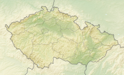
editVšeruby is located about 12 kilometres (7 mi) south of Domažlice and 52 km (32 mi) southwest of Plzeň, on the border with Germany. It lies in the Cham-Furth Depression. The highest point is at 574 m (1,883 ft) above sea level. The Chamb River flows through the eastern part of the municipal territory and then forms a part of the Czech-German border. The brook Hájecký potok (a tributary of the Chamb) originates here and supplies Všerubský Pond, which is a large pond in the centre of Všeruby.
History
editThe first written mention of Všeruby is from 1570, when it was promoted to a market town. It was then a part of the Rýzmberk estate, owned by Lords of Gutštejn. The owners of Všeruby often changed and included various less prominent noble families. From 1697 until the establishment of a sovereign municipality in 1848, Všeruby was property of the Stadion family.[2]
At the end of World War II, on 4 May 1945, the German 11th Panzer Division under command of General Wend von Wietersheim surrendered to the US 90th Infantry Division at Všeruby.[3]
Demographics
edit
|
|
| ||||||||||||||||||||||||||||||||||||||||||||||||||||||
| Source: Censuses[4][5] | ||||||||||||||||||||||||||||||||||||||||||||||||||||||||
Transport
editThere are no railways or major roads passing through the municipality. On the Czech-German border is the road border crossing Všeruby / Eschlkam.
Sights
editThe main landmark of Všeruby is the Church of Saint Michael the Archangel. It was built in the Renaissance style in 1628–1650. A chapel was added to the church in the 18th century. The present appearance of the church is a result of the reconstruction in the second half of the 19th century, after it was damaged by a fire.[6]
The Church of Saint Anne is located in Hájek. It was built in the Baroque style in 1712–1717 on the site of an old wooden chapel. It is a pilgrimage site.[7]
References
edit- ^ "Population of Municipalities – 1 January 2024". Czech Statistical Office. 2024-05-17.
- ^ "O založení městečka a jeho vrchnosti" (in Czech). Městys Všeruby. Retrieved 2023-06-15.
- ^ "The U.S. Army in Czechoslovakia 1945: An Operational Overview". Military History Online. Retrieved 2023-06-15.
- ^ "Historický lexikon obcí České republiky 1869–2011" (in Czech). Czech Statistical Office. 2015-12-21.
- ^ "Population Census 2021: Population by sex". Public Database. Czech Statistical Office. 2021-03-27.
- ^ "Kostel sv. archanděla Michaela" (in Czech). National Heritage Institute. Retrieved 2023-06-15.
- ^ "Kostel sv. Anny" (in Czech). National Heritage Institute. Retrieved 2023-06-15.
External links
edit


