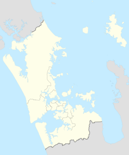
Te Unuhanga-a-Rangitoto / Mercer Bay is a bay on the Auckland Region of New Zealand's North Island. It is located south of Piha and north of Karekare. The bay is surrounded by 60 m (200 ft)-high cliffs, which are the tallest in the Auckland Region.
| Te Unuhanga-a-Rangitoto / Mercer Bay | |
|---|---|
 View of Te Unuhanga-a-Rangitoto / Mercer Bay from the Mercer Bay Loop track | |
| Location | Auckland Region, New Zealand |
| Coordinates | 36°58′44″S 174°28′05″E / 36.979°S 174.468°E |
| Ocean/sea sources | Tasman Sea |
Description
editTe Unuhanga-a-Rangitoto / Mercer Bay is on the west coast of the Auckland Region, between Te Ahua Point and Farley Point, north-west of Karekare.[1] The bay has the tallest cliffs found in the Auckland Region,[2][3] which are over 60 metres (200 ft) high.[4]
The beach disappears entirely at high tide.[3] The northern end of the beach is the location of Te Ana Areare, caves traditionally used as a refuge by Te Kawerau ā Maki, and a shag colony is found at the southern end of the beach.[3]
History
editThe bay is within the traditional rohe of the Te Kawerau ā Maki iwi. Te Unuhanga-a-Rangitoto ("Place from Where Rangitoto Was Drawn") refers to a traditional story involving the ancient supernatural ancestor Tiriwa, who lifts Rangitoto Island from its location on the Tasman Sea to the Hauraki Gulf, as a show of his power to other Tūrehu.[1][5][6] Another traditional story involving the area is Te Ahua o Hinerangi, the story of Hinerangi who fell to her death at Te Ahua Point.[4]
After the land was acquired by the Crown, it was granted to a settler named Andrew Mercer, who became the namesake of the bay's English language name.[5]
The Māori language name for the bay was officially added in November 2015 by the New Zealand Geographic Board under the terms of Te Kawerau ā Maki Claims Settlement Act 2015.[1][7]
The Mercer Bay Loop Track is a popular walking track along the cliffs above the bay.[5] After kauri dieback led to the closure of many Waitākere Ranges tracks, the Mercer Bay Loop Track grew significantly in popularity.[4] Numerous deaths and disappearances have been linked to the bay.[8][9]
References
edit- ^ a b c "Place name detail: Te Unuhanga-a-Rangitoto / Mercer Bay". New Zealand Gazetteer. New Zealand Geographic Board. Retrieved 10 November 2023.
- ^ Cattin, Matthew (20 October 2021). "Best of the west". Wilderness Magazine. Retrieved 10 November 2023.
- ^ a b c Harvey, Bob (2012). Untamed Coast: Auckland's Waitakere Ranges and Heritage Area (revised and updated ed.). Auckland: Exisle Publishing. p. 117, 140-143. ISBN 978-0-908988-67-9.
- ^ a b c "Is this New Zealand's most reckless selfie spot?". The New Zealand Herald. 16 September 2019. Retrieved 10 November 2023.
- ^ a b c Dench, Alison; Parore, Lee-Anne (2014). Walking the Waitakere Ranges: 45 Coastal and Bush Walks (4th ed.). Auckland: New Holland Publishers. pp. 83–85. ISBN 978-1-86966-426-8. OCLC 894037427. OL 30857674M. Wikidata Q123383221.
- ^ Murdoch, Graeme (1992). "Wai Karekare - 'The Bay of the Boisterous Seas'". In Northcote-Bade, James (ed.). West Auckland Remembers, Volume 2. West Auckland Historical Society. p. 13. ISBN 0-473-01587-0.
- ^ "Notice of new and altered geographic names for Te Kawerau ā Maki Treaty of Waitangi Settlement 2015". New Zealand Gazette. 12 November 2015. Retrieved 13 November 2023.
- ^ Hurley, Sam (29 March 2017). "'They can't just disappear without a trace' Two women vanished from a Piha track". The New Zealand Herald. Retrieved 10 November 2023.
- ^ Cleave, Louisa (5 September 2006). "Pause for photo ends in woman's death plunge". The New Zealand Herald. Retrieved 10 November 2023.
