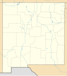
Tatum Airport (FAA LID: 18T, formerly E07)[2] is a public use airport located three nautical miles (6 km) east of the central business district of Tatum, a town in Lea County, New Mexico, United States.[1] Currently owned by the Town of Tatum,[1] it was formerly owned by the New Mexico Department of Transportation.[2]
Tatum Airport | |||||||||||||||
|---|---|---|---|---|---|---|---|---|---|---|---|---|---|---|---|
| Summary | |||||||||||||||
| Airport type | Public | ||||||||||||||
| Owner | Town of Tatum | ||||||||||||||
| Serves | Tatum, New Mexico | ||||||||||||||
| Elevation AMSL | 3,986 ft / 1,215 m | ||||||||||||||
| Coordinates | 33°15′39″N 103°16′43″W / 33.26083°N 103.27861°W | ||||||||||||||
| Map | |||||||||||||||
 | |||||||||||||||
| Runways | |||||||||||||||
| |||||||||||||||
| Statistics (2023) | |||||||||||||||
| |||||||||||||||
Facilities and aircraft
editTatum Airport covers an area of 320 acres (129 ha) at an elevation of 3,986 feet (1,215 m) above mean sea level. It has two runways with asphalt surfaces. Runway 12/30, the only active runway, is 2,920 by 60 feet (890 x 18 m). Runway 5/23 is closed indefinitely and measures 2,990 by 75 feet (911 x 23 m).
For the 12-month period ending March 31, 2023 the airport had 500 general aviation aircraft operations, an average of 42 per month.
References
edit- ^ a b c FAA Airport Form 5010 for 18T PDF. Federal Aviation Administration. Effective November 30, 2023.
- ^ a b "E07 – Tatum Airport". FAA data republished by AirNav. September 25, 2008. Archived from the original on October 11, 2008.
External links
edit- Aerial image as of November 1997 from USGS The National Map
- Resources for this airport:
- FAA airport information for 18T
- AirNav airport information for 18T
- FlightAware airport information and live flight tracker
- SkyVector aeronautical chart for 18T
