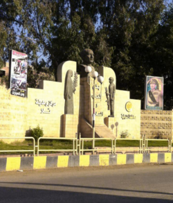
Tala (Arabic: تلا), located in the Nile Delta region of northern Monufia Governorate, Egypt, is known for its lush, fertile landscapes and historical significance. As part of a traditionally agricultural governorate, Tala is surrounded by greenery, with fields of crops and palm trees across its landscape, typical of the Nile Delta’s rich agricultural setting.
Tala
تلا | |
|---|---|
 | |
 Location in Monufia Governorate | |
| Coordinates: 30°40′48″N 30°56′38″E / 30.680108°N 30.943758°E | |
| Country | |
| Governorate | Monufia |
| Area | |
• Total | 188.3 km2 (72.7 sq mi) |
| Population (2021)[1] | |
• Total | 413,839 |
| • Density | 2,200/km2 (5,700/sq mi) |
| Time zone | UTC+2 (EST) |
| Climate | BWh |
The town is characterized by a close-knit community where families have lived for generations, fostering a strong sense of local identity and tradition. Tala’s heritage is deeply rooted in rural Egyptian culture, evident in its food, architecture, and local customs. Alongside its rural atmosphere, Tala boasts a vibrant marketplace where locals gather to trade fresh produce, handmade crafts, and other goods, reflecting the communal lifestyle of the Delta region.
See also
editReferences
edit- ^ a b "Talā (Markaz, Egypt) - Population Statistics, Charts, Map and Location". www.citypopulation.de. Retrieved 18 March 2023.
