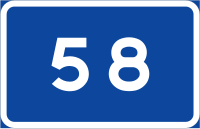
National roads (Swedish: riksväg; literally: road of the rike/realm) in Sweden have road numbers from 1 through 99. The national roads are usually of high quality and sometimes pass through several counties. Roads with lower numbers are in southern Sweden, and roads with higher numbers are in northern Sweden. There are many cases where two or more routes in this system share the same physical road for a considerable distance, giving the country several kilometers of double-numbered road.


This article needs additional citations for verification. (October 2017) |
The network of national roads covers all of Sweden. In 2015, the total length of all national roads (excluding European routes) was 8,900 km (5,500 mi).[1] The only county that does not have a riksväg is Gotland County. On Gotland and the adjacent island of Öland, the main roads are instead known as county road (länsväg). The national roads are public roads owned by the Government of Sweden and administered by the Swedish Transport Administration. They get a high priority for snow plowing during the winter.
The roads' number signs are rectangular with a blue background, white numbers, and a white border.
Current Swedish national roads
editAs of 2017, Sweden has 57 national roads.
Swedish national roads that have changed designation over the years
edit- 10, Trelleborg – Brösarp — current National road 9[7]
- 12, Malmö – Simrishamn — current National road 11
- 15, Malmö – Norrköping — current European route E22, reassigned to a different route
- 16, Dalby – Flädie – current County road 102 and E6.02 (not signposted)[4][8]
- 20, Ystad – Broby — current National road 19
- 45, Gothenburg – Karesuando — current European route E45[9]
- 48, Slättäng – Mariestad — current National road 26
- 60, Örebro – Falun — current National road 50
- 64, Hassle – Mora — current National road 26
- 65, Västerås – Ludvika — current National road 66
- 71, Borlänge – Norwegian border (Stöa) — current European route E16 and National road 66[5][6]
- 80, Gävle – Rättvik — current European route E16 and National road 69[5][6]
- 81, Mora – Östersund — current European route E45
- 82, Söderhamn – Voxna — current National road 50 and County road 301
- 88, Östersund – Karesuando — current European route E45
- 93, Umeå – Storuman — current European route E12
- 98, Luleå – Kiruna — current European route E10, reassigned to a different route
- 99, Sangis – Hedenäset — current County road 398, reassigned to a different route
The classic Swedish national roads
editThese are the Swedish national roads that existed before the large restructuring that happened when the European routes were implemented in 1962 in Sweden.
- Road 1, Riksettan, Helsingborg – Stockholm — current European route E4
- Road 2, Rikstvåan, Trelleborg – Svinesund bridge — current European route E6
- Road 3, Rikstrean, Connection road between riksettan and rikstvåan outside Helsingborg, Kropp – Hasslarp – Strövelstorp
- Road 4, Riksfyran, Malmö – Norrköping — current European route E22
- Road 5, Riksfemman, Gothenburg – Jönköping — current National road 40
- Road 6, Rikssexan, Gothenburg – Örebro – Södertälje – Stockholm — current European route E20
- Road 7, Rikssjuan, Gothenburg – Grums — current European route E45
- Road 8, Riksåttan, Ödeshög – Hallsberg — current National road 50
- Road 9, Riksnian, Norwegian border – Karlskoga — current European route E18
- Road 10, Rikstian, Örebro – Gävle — current National road 50 and European route E16
- Road 11, Rikselvan, Arboga – Enköping — current European route E18
- Road 12, Rikstolvan, Solna – Mora — current E18 and National road 70
- Road 13, Rikstretton, Stockholm – Haparanda — current European route E4
- Road 14, Riksfjorton, Sundsvall – Norwegian border — current European route E14
See also
edit- Swedish county road (Länsväg)
- Norwegian national road
References
edit- ^ "Sveriges vägnät". trafikverket.se (in Swedish). Swedish Transport Administration. Archived from the original on 2017-08-04. Retrieved 2018-12-04.
- ^ a b c Nationell vägdatabas (NVDB) [National road database] (Map) (in Swedish). Swedish Transport Administration. Retrieved 2017-11-04.
- ^ a b "Transportstyrelsens föreskrifter om vägvisningsplan för riksvägar och länsvägar i nummergruppen 100–499" (PDF). Transportstyrelsens författningssamling (in Swedish). Swedish Transport Agency. 2012. pp. 7–12. ISSN 2000-1975. TSFS 2012:73. Retrieved 2021-06-12.
- ^ a b Konsekvensutredning - Transportstyrelsens föreskrifter om vägvisningsplan för riksvägar och länsvägar i nummergruppen 0- 499 (PDF) (Report) (in Swedish). Swedish Transport Agency. 2012-04-04. pp. 2–3. Archived (PDF) from the original on 2017-10-30. Retrieved 2017-10-30.
- ^ a b c d "Vår nya Europaväg". Sveriges Radio (in Swedish). 2012-08-27. Retrieved 2017-10-29.
- ^ a b c d "Sammanställning 20 FS 2012:3 enligt 13 kap 1 § trafikförordningen (1998:1276) (TrF) över allmänna vägar och andra viktigare vägar i Dalarnas län" (PDF). Dalarnas läns författningssamling (in Swedish). County Administrative Board of Dalarna. April 2012. pp. 6–8. Archived (PDF) from the original on 2018-11-05. Retrieved 2017-10-29.
- ^ TT (1992-03-25). "Europavägar skyltas om". Dagens Nyheter (in Swedish). Retrieved 2017-11-04.
- ^ "Så får vägarna namn". Sveriges Radio (in Swedish). 2012-09-13. Retrieved 2017-10-30.
- ^ "Riksväg 45 blir Europaväg". Sveriges Radio (in Swedish). 2005-10-18. Retrieved 2017-11-03.