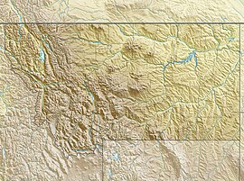
Sunset Peak is a 10,201-foot (3,109-metre) summit in Park County, Montana, United States.
| Sunset Peak | |
|---|---|
 East aspect | |
| Highest point | |
| Elevation | 10,201 ft (3,109 m)[1] |
| Prominence | 160 ft (49 m)[2] |
| Parent peak | Meridian Peak[2] |
| Isolation | 0.70 mi (1.13 km)[2] |
| Coordinates | 45°02′43″N 110°00′01″W / 45.0454087°N 110.0003064°W[1] |
| Geography | |
| Country | United States |
| State | Montana |
| County | Park |
| Protected area | Yellowstone National Park |
| Parent range | Absaroka Range[3] Rocky Mountains |
| Topo map | USGS Cutoff Mountain |
| Geology | |
| Rock age | Tertiary[5] |
| Rock type | Volcanic rock, Rhyolite[4] |
Description
editSunset Peak is located 3.75 miles (6.04 km) northwest of Cooke City, Montana, in the Absaroka Range which is a subrange of the Rocky Mountains. It is set in the northeast corner of Yellowstone National Park on the common boundary shared by the park and Custer-Gallatin National Forest.[2] Precipitation runoff from the mountain's north slope drains into headwaters of the Stillwater River, whereas the southwest slope drains into Pebble Creek and the southeast slope drains into headwaters of Sheep Creek which are both part of the Lamar River watershed. Topographic relief is significant as the summit rises 1,600 feet (488 meters) above each of the three streams in one mile (1.6 km). The mountain's toponym has been officially adopted by the United States Board on Geographic Names,[1] and has been featured in publications since at least 1901.[4]
Climate
editBased on the Köppen climate classification, Sunset Peak is located in a subarctic climate zone characterized by long, usually very cold, snowy winters, and mild summers.[6] Winter temperatures can drop below 0 °F with wind chill factors below −10 °F.
See also
editGallery
editReferences
edit- ^ a b c "Sunset Peak". Geographic Names Information System. United States Geological Survey, United States Department of the Interior. Retrieved August 13, 2024.
- ^ a b c d "Sunset Peak - 10,220' MT". listsofjohn.com. Retrieved August 12, 2024.
- ^ Montana's 300 Tallest Peaks, Montana State Library, Montana.gov, Retrieved 2024-08-13.
- ^ a b Bulletin of the United States Geological Survey. No. 177, U.S. Geological Survey, 1901, US Government Printing Office, p. 656.
- ^ Atlas of Yellowstone: Second Edition, W. Andrew Marcus, University of California Press, 2022, ISBN 9780520976924, p. 129.
- ^ Peel, M. C.; Finlayson, B. L.; McMahon, T. A. (2007). "Updated world map of the Köppen−Geiger climate classification". Hydrol. Earth Syst. Sci. 11 (5): 1633–1644. Bibcode:2007HESS...11.1633P. doi:10.5194/hess-11-1633-2007. ISSN 1027-5606. S2CID 9654551.
External links
edit- Sunset Peak: weather

