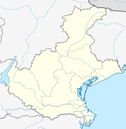
Stienta is a comune (municipality) in the Province of Rovigo in the Italian region Veneto, located about 80 kilometres (50 mi) southwest of Venice and about 25 kilometres (16 mi) southwest of Rovigo. As of 31 December 2004, it had a population of 3,118 and an area of 24.1 square kilometres (9.3 sq mi).[3]
Stienta | |
|---|---|
| Comune di Stienta | |
| Coordinates: 44°56′N 11°33′E / 44.933°N 11.550°E | |
| Country | Italy |
| Region | Veneto |
| Province | Province of Rovigo (RO) |
| Frazioni | Argine Sabato, Argine Valle Est, Argine Valle Ovest, Beccari, Bentivoglio, Boaria Gilliola, Boaria Guerra, Boaria Roveta, Boaria Val dell'Oca e Casetta, Boaria Val di Mezzo, Boaria Varotta, Brigo, Chiavicone, Fazzenda, Folega, Guratti, Ponte Favarzano, Prati Nuovi, Sabbioni, Zampine |
| Area | |
• Total | 24.1 km2 (9.3 sq mi) |
| Population (Dec. 2004)[2] | |
• Total | 3,118 |
| • Density | 130/km2 (340/sq mi) |
| Demonym | Stientesi |
| Time zone | UTC+1 (CET) |
| • Summer (DST) | UTC+2 (CEST) |
| Postal code | 45039 |
| Dialing code | 0425 |
| Website | Official website |
The municipality of Stienta contains the frazioni (subdivisions, mainly villages and hamlets) Argine Sabato, Argine Valle Est, Argine Valle Ovest, Beccari, Bentivoglio, Boaria Gilliola, Boaria Guerra, Boaria Roveta, Boaria Val dell'Oca e Casetta, Boaria Val di Mezzo, Boaria Varotta, Brigo, Chiavicone, Fazzenda, Folega, Guratti, Ponte Favarzano, Prati Nuovi, Sabbioni, and Zampine.
Stienta borders the following municipalities: Bagnolo di Po, Castelguglielmo, Ferrara, Fiesso Umbertiano, Gaiba, Occhiobello.
Demographic evolution
edit
References
edit- ^ "Superficie di Comuni Province e Regioni italiane al 9 ottobre 2011". Italian National Institute of Statistics. Retrieved 16 March 2019.
- ^ "Popolazione Residente al 1° Gennaio 2018". Italian National Institute of Statistics. Retrieved 16 March 2019.
- ^ All demographics and other statistics: Italian statistical institute Istat.
External links
edit


