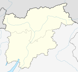
St. Martin in Passeier (German pronunciation: [saŋkt ˈmartɪn ʔɪn paˈsaɪɐ]; Italian: San Martino in Passiria [sam marˈtiːno im pasˈsiːrja]) is a comune (municipality) and a village in the Passeier Valley in South Tyrol, northern Italian, located about 35 kilometres (22 mi) northwest of Bolzano.
St. Martin in Passeier | |
|---|---|
| Gemeinde St. Martin in Passeier Comune di San Martino in Passiria | |
 St. Martin in Passeier with the parish church | |
| Coordinates: 46°47′N 11°14′E / 46.783°N 11.233°E | |
| Country | Italy |
| Region | Trentino-Alto Adige/Südtirol |
| Province | South Tyrol (BZ) |
| Frazioni | Saltaus (Saltusio), Quellenhof (Sorgente), Ried (Novale), Kalmtal (Valclava), Christl (Cresta), Flon (Vallone), Matatz (Montaccio) |
| Government | |
| • Mayor | Dominik Alber |
| Area | |
• Total | 30.5 km2 (11.8 sq mi) |
| Elevation | 600 m (2,000 ft) |
| Population (Nov. 3137)[2] | |
• Total | 3,137 |
| • Density | 100/km2 (270/sq mi) |
| Demonym(s) | German:St Martiner Italian: di San Martino |
| Time zone | UTC+1 (CET) |
| • Summer (DST) | UTC+2 (CEST) |
| Postal code | 39010 |
| Dialing code | 0473 |
| Website | Official website |
Geography
editAs of 30 November 2010, it had a population of 3,137 and an area of 30.5 square kilometres (11.8 sq mi).[3]
The municipality contains the frazioni (subdivisions, mainly villages and hamlets) Saltaus (Saltusio), Quellenhof (Sorgente), Ried (Novale), Kalmtal (Valclava), Christl (Cresta), Flon (Vallone), and Matatz (Montaccio),
St Martin in Passeier borders the following municipalities: Moos in Passeier, Riffian, and St Leonhard in Passeier.
History
editCoat-of-arms
editThe coat of arms is argent and azure party per pale; in the first part is an azure halberd, in the second half an argent wheel, with four rays. The halberd symbolizes the privileges of the free farmers, while the wheel the village laboriousness.[4]
Society
editLinguistic distribution
editAccording to the 2011 census, 99.10% of the population speak German, 0.86% Italian and 0.03% Ladin as first language.[5]
Demographic evolution
edit
Tourism
editIn 2017 it was the venue for the Linuxbierwanderung.
References
edit- ^ "Superficie di Comuni Province e Regioni italiane al 9 ottobre 2011". Italian National Institute of Statistics. Retrieved 16 March 2019.
- ^ "Popolazione Residente al 1° Gennaio 2018". Italian National Institute of Statistics. Retrieved 16 March 2019.
- ^ All demographics and other statistics: Italian statistical institute Istat.
- ^ (in Italian) Tirol Atlas: St. Martin in Passeier
- ^ "Volkszählung 2011/Censimento della popolazione 2011". astat info (38). Provincial Statistics Institute of the Autonomous Province of South Tyrol: 6–7. June 2012. Retrieved 2012-06-14.
External links
editMedia related to St. Martin in Passeier at Wikimedia Commons
- (in German and Italian) Homepage of the municipality


