This article relies largely or entirely on a single source. (July 2020) |
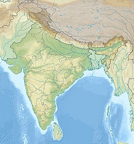
Sadhna pass, also known as Sadna Top and previously called Nastachun pass[a] is a mountain pass in Jammu and Kashmir, India. It is located in the Himalayas and connects Karnah tehsil in the Kishanganga valley of Kupwara district with the Kashmir valley. It is approximately 30 km away from the town of Kupwara. It is located in the vast Shams Bari mountain range at about 3,130 m (10,269 ft) above sea level. The pass is best known for a mythological legend of Blind and Deaf Fairies, and for its association with Bollywood actress Sadhana.
| Sadhna Pass | |
|---|---|
| Elevation | 3,000 m (9,843 ft) |
| Location | Jammu and Kashmir, India |
| Range | Shams Bari Range |
| Coordinates | 34°24′N 73°57′E / 34.40°N 73.95°E |
Sadhna Pass is notable for its elevation and challenging weather conditions, particularly during the winter months when heavy snowfall can lead to the pass being closed.[citation needed] Due to its strategic location and scenery, it has gained attention as both a transportation route and a destination for travelers and adventurers.[citation needed]
The pass has undergone name changes over the years, from its previous designation as Nastachun Pass to its current name, Sadhna Pass. This transition in nomenclature reflects the historical and cultural shifts in the region.
Overall, Sadhna Pass plays a role in connecting various regions in Jammu and Kashmir, while also offering a glimpse of the natural landscapes that characterize this part of India.[tone]
References
edit- ^ Originally called Nasta Chun, meaning "cut nose", the pass came to be popularly referred to as the Sadhna pass or Sadhna Top after a 1960s visit by Bollywood actress Sadhana Shivdasani.
Climate
edit| Climate data for Sadhna Pass (1981–2023 via satellite based observations) | |||||||||||||
|---|---|---|---|---|---|---|---|---|---|---|---|---|---|
| Month | Jan | Feb | Mar | Apr | May | Jun | Jul | Aug | Sep | Oct | Nov | Dec | Year |
| Record high °C (°F) | 7.4 (45.3) |
10.1 (50.2) |
13.2 (55.8) |
19.8 (67.6) |
24.7 (76.5) |
29.1 (84.4) |
32.2 (90.0) |
31.6 (88.9) |
28.9 (84.0) |
21.5 (70.7) |
12.7 (54.9) |
9.2 (48.6) |
32.2 (90.0) |
| Mean daily maximum °C (°F) | −2.8 (27.0) |
−1.9 (28.6) |
3.1 (37.6) |
7.1 (44.8) |
13.4 (56.1) |
18.7 (65.7) |
19.8 (67.6) |
19.3 (66.7) |
18.1 (64.6) |
9.5 (49.1) |
1.8 (35.2) |
−2.1 (28.2) |
8.7 (47.6) |
| Mean daily minimum °C (°F) | −13.4 (7.9) |
−12.1 (10.2) |
−8.7 (16.3) |
−4.3 (24.3) |
−1.8 (28.8) |
4.1 (39.4) |
7.9 (46.2) |
7.6 (45.7) |
4.7 (40.5) |
−5.1 (22.8) |
−9.4 (15.1) |
−13.1 (8.4) |
−3.6 (25.5) |
| Record low °C (°F) | −32.7 (−26.9) |
−30.4 (−22.7) |
−21.4 (−6.5) |
−13.1 (8.4) |
−11.3 (11.7) |
−4.8 (23.4) |
1.4 (34.5) |
−3.9 (25.0) |
−5.4 (22.3) |
−13.4 (7.9) |
−23.1 (−9.6) |
−28.2 (−18.8) |
−32.7 (−26.9) |
| Source: India Meteorological Department[1] | |||||||||||||
- ^ "Station: Kupwara Climatological Table 1981–2010" (PDF). Climatological Normals 1981–2010. India Meteorological Department. January 2015. pp. 441–442. Archived from the original (PDF) on 5 February 2020. Retrieved 24 March 2020.

