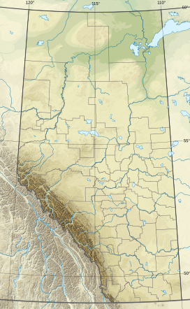
Roche Miette (/rɒʃ maɪˈɛt/) is a 2,316-metre (7,598-foot) mountain at the northwestern tip of the Miette Range in Jasper National Park, in the Canadian Rockies of Alberta, Canada. The peak is a prominent landmark in the Athabasca Valley that is situated approximately thirty kilometres north-northeast of the municipality of Jasper, and four kilometres northeast of the Jasper House National Historic Site. It is visible from Highway 16 and the Canadian. Its nearest higher peak is Capitol Mountain, 5.0 km (3.1 mi) to the southeast.[5] Roche Miette translates from French as Crumb Rock.
| Roche Miette | |
|---|---|
 Roche Miette | |
| Highest point | |
| Elevation | 2,316 m (7,598 ft)[1][2] |
| Prominence | 45 m (148 ft)[1] |
| Listing | Mountains of Alberta |
| Coordinates | 53°09′48″N 117°55′11″W / 53.16333°N 117.91972°W[3] |
| Geography | |
 | |
| Interactive map of Roche Miette | |
| Location | Jasper National Park Alberta, Canada |
| Parent range | Miette Range[1] Canadian Rockies |
| Topo map | NTS 83F4 Miette[3] |
| Geology | |
| Rock type | sedimentary rock |
| Climbing | |
| Easiest route | Scrambling[4] |
History
editAccording to James Hector and folklore, Bonhomme Miette, a French Canadian voyageur and gifted fiddler, made the first ascent by climbing it from its south side.[2][6] (The Fiddle River and Fiddle Range are located immediately northeast of Roche Miette and Miette Range.)
In 1907 Arthur P. Coleman wrote of it: "The most impressive bit of architecture along the Athabasca, pushing its bold front out into the valley like a commanding fort with unscalable walls three thousand feet high, and a flat top somewhat parapeted and loop-holed."[2]
The mountain's name was officially adopted in 1956 by the Geographical Names Board of Canada.[3]
Geology
editRoche Miette is composed of sedimentary rock laid down during the Precambrian to Jurassic periods and later pushed east and over the top of younger rock during the Laramide orogeny.[7] The summit block is made of Palliser Formation limestone.[4]
Climate
editBased on the Köppen climate classification, Roche Miette is in a subarctic climate with cold, snowy winters, and mild summers.[8] Temperatures can drop below −20 °C with wind chill factors below −30 °C. In terms of favourable weather, June through September are the best months to climb. Precipitation runoff from Roche Miette drains into the Athabasca River.
Gallery
edit-
Looking northeast at Roche Miette from Highway 16
See also
editReferences
edit- ^ a b c "Roche Miette, Alberta". Peakbagger.com. Retrieved 2021-03-21.
- ^ a b c "Roche Miette". cdnrockiesdatabases.ca. Retrieved 2021-03-21.
- ^ a b c "Roche Miette". Geographical Names Data Base. Natural Resources Canada. Retrieved 2018-12-27.
- ^ a b Alan Kane (1999). "Roche Miette". Scrambles in the Canadian Rockies. Rocky Mountain Books. p. 427. ISBN 0-921102-67-4.
- ^ "Roche Miette". Bivouac.com. Retrieved 2018-12-27.
- ^ Place-names of Alberta. Ottawa: Geographic Board of Canada. 1928. p. 87.
- ^ Gadd, Ben (2008), Geology of the Rocky Mountains and Columbias
- ^ Peel, M. C.; Finlayson, B. L.; McMahon, T. A. (2007). "Updated world map of the Köppen−Geiger climate classification". Hydrol. Earth Syst. Sci. 11: 1633–1644. ISSN 1027-5606.
External links
edit- Weather forecast: Roche Miette
- Parks Canada web site: Jasper National Park

