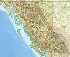
The Rainy River is a short river that enters the Thornbrough Channel at Port Mellon, British Columbia, Canada. While it does come close to doing so, it never enters Tetrahedron Provincial Park.[3]
| Rainy River | |
|---|---|
| Location | |
| Country | Canada |
| Province | British Columbia |
| Physical characteristics | |
| Source | An unnamed lake north of Tetrahedron Peak |
| • location | Pacific Ranges |
| • coordinates | 49°37′44″N 123°32′42″W / 49.62889°N 123.54500°W |
| • elevation | 1,068 m (3,504 ft)[1] |
| Mouth | Thornbrough Channel |
• location | Port Mellon |
• coordinates | 49°31′16″N 123°28′48″W / 49.52111°N 123.48000°W |
• elevation | 0 m (0 ft)[2] |
Course
editThe Rainy River originates in a small unnamed lake just north of Tetrahedron Peak. The river, shortly after exiting the lake, likely drops over a fairly tall waterfall as it drops down a headwall. The river flows southeast for about 3.6 km before turning south and flowing that way for about 9.8 km to its mouth at Port Mellon. The river does not receive any major tributaries.
See also
editReferences
edit- ^ Source elevation derived from Google Earth search using BCGNIS source coordinates.
- ^ Mouth elevation derived from Google Earth search using BGNIS source coordinates.
- ^ "Rainy River". BC Geographical Names.

