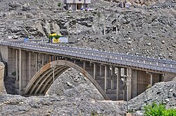
Raikot Bridge is a road bridge situated on the Karakoram Highway, spanning the River Indus. It is the gateway to Nanga Parbat base camp, in Diamer District, Gilgit Baltistan, Pakistan.[1][2]
Raikot Bridge رائے کوٹ پل | |
|---|---|
 | |
| Coordinates | 35°29′35.03″N 74°35′31.09″E / 35.4930639°N 74.5919694°E |
| Carries | Cars, buses, trucks, jeeps |
| Crosses | River Indus |
| Locale | Diamer District |
| Maintained by | National Highway Authority |
| Characteristics | |
| Design | Arch bridge |
| No. of lanes | 2 |
| Location | |
 | |
From there, the Highway continues all the way up to Khunjerab Pass and into China. Alternatively, tourists can hire jeeps from the Bridge and follow an unmetalled track to Tattu Village, a journey which takes around 90 minutes.[3][4][5] A further three-hour hike takes one to the Fairy Meadows National Park.[6]
Services
editA small junction village is located around the bridge. It houses a few hotels, several small shops and restaurants, and a mosque.[7]
Upgrades
editOn January 18, 2008, China Eximbank and the Government of Pakistan signed a $327,740,000 loan agreement for the Karakoram Highway Improvement (Raikot-Khunjerab Section) Project. This project, also known as the Karakoram Highway (KKH) Upgrade Project, involved the upgrading of a 335 km segment of the Karakoram Highway that runs from Raikot to Khunjerab. This segment was widened from 10 to 30 meters, making it suitable for heavy and long vehicles and allowing it to remain functional throughout the year. 32 new bridges were also constructed, while 27 were rehabilitated. The total cost of the project was $491 million. The China Road and Bridge Corporation (CRBC) and the Pakistan National Highway Authority (NHA) were responsible for implementation of the project, while National Engineering Services Pakistan (NESPAK) served as a consultant for the project.
A groundbreaking ceremony was held on February 16, 2008, after which construction began on August 1, 2008. The project was successfully completed on November 30, 2013. The road work was designed and constructed in accordance with China's three-level highway standard. Final inspection of the project was carried out by NHA Inspection Wing.[8][9]
See also
editReferences
edit- ^ "Fairy Meadows Cottages". Fairy Medows Official Website. Retrieved 29 October 2012.
- ^ "Raikot Bridge - Raikot - District Diamer". lovemypakistan.com. 24 June 2019. Retrieved 2022-01-04.
- ^ Zaman, Fahim (2020-11-29). "DEATH OF A RIVER". DAWN.COM. Retrieved 2022-01-04.
- ^ "Experiencing the tranquil Fairy Meadows — Part I". Daily Times. 2018-05-11. Retrieved 2022-01-04.
- ^ "Fairy Meadow — heaven on earth". www.thenews.com.pk. Retrieved 2022-01-04.
- ^ "Over the top: Misreporting on location of Nanga Parbat attack". The Express Tribune. 2013-07-28. Retrieved 2022-01-04.
- ^ "Fairy Meadows & Nanga Parbat Base Camp Guide [2021 UPDATE]". Ultimate Gear Lists. Retrieved 2022-01-04.
- ^ "Project | china.aiddata.org". china.aiddata.org. Retrieved 2022-01-04.
- ^ "Feature: Friendship highway leads Pakistan's Hunza to prosperity - Xinhua | English.news.cn". www.xinhuanet.com. Retrieved 2022-01-04.