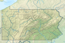
Rabbit Run is a tributary of the Delaware River contained wholly within Solebury Township, Bucks County, Pennsylvania.
| Rabbit Run | |
|---|---|
| Location | |
| Country | United States |
| State | Pennsylvania |
| County | Bucks |
| Township | Solebury |
| Physical characteristics | |
| Source | |
| • coordinates | 40°21′59″N 75°58′4″W / 40.36639°N 75.96778°W |
| • elevation | 340 feet (100 m) |
| Mouth | |
• coordinates | 40°22′31″N 74°57′24″W / 40.37528°N 74.95667°W |
• elevation | 79 feet (24 m) |
| Length | 0.29 miles (0.47 km) |
| Basin size | 0.42 square miles (1.1 km2) |
| Basin features | |
| Progression | Rabbit Run → Delaware River → Delaware Bay |
| River system | Delaware River |
| Bridges | U.S. Route 202 (Lower York Road) Business Route 202 (Lower York Road) Pennsylvania Route 32 (River Road) |
| Slope | 906.56 feet per mile (171.697 m/km) |
Statistics
editThe Geographic Information System I.D. is 1184568.[1] U.S. Department of the Interior Geological Survey I.D. is 03065.[2] The watershed of Rabbit Run is 0.42 square miles (1.1 km2) and it meets its confluence at the Delaware River's 149.45 river mile.
Course
editRabbit Run rises in Solebury Township from two unnamed ponds adjacent to U.S. Route 202, flowing generally northeast passing through the Pat Livezey Park, meeting its confluence with the Delaware River a short distance south of the bridge carrying U.S. Route 202.
Municipalities
editCrossings and Bridges
edit- U.S. Route 202 (Lower York Road)
- Business Route 202 (Lower York Road)
- Pennsylvania Route 32 (River Road)
- Lower York Road (business Route 202)
- U.S. Route 202 (Lower York Road)
References
edit- ^ "GNIS Feature Search". geonames.usgs.gov. U.S. Geological Survey, U.S. Department of the Interior. Retrieved 24 September 2017.
- ^ "Gazeteer of streams" (PDF). www.lycoming.edu.
