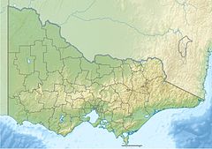
The Powlett River (Boonwurrung: Kugerungmome) is a perennial river of the West Gippsland catchment, located in the West Gippsland region of the Australian state of Victoria.
| Powlett | |
|---|---|
| Etymology | In honour of Frederick Powlett, the Commissioner of the District of Western Port[1][2][3] |
| Native name | Kugerungmome (Boonwurrung)[4] |
| Location | |
| Country | Australia |
| State | Victoria |
| Region | South East Coastal Plain (IBRA), West Gippsland |
| Local government area | Bass Coast |
| Physical characteristics | |
| Source | Strzelecki Ranges |
| • location | near Ellerside, north of Inverloch |
| • coordinates | 38°32′38″S 145°44′35″E / 38.54389°S 145.74306°E |
| • elevation | 42 m (138 ft) |
| Mouth | Bass Strait |
• location | west of Wonthaggi |
• coordinates | 38°35′0″S 145°30′39″E / 38.58333°S 145.51083°E |
• elevation | 0 m (0 ft) |
| Length | 27 km (17 mi) |
| Basin features | |
| River system | West Gippsland catchment |
| Tributaries | |
| • right | Foster Creek |
| [5][6] | |

Location and features
editThe Powlett River rises on the southern slopes of the Strzelecki Ranges, near Ellerside, north of Inverloch, and flows generally west, joined by one minor tributary, before reaching its mouth within Bass Strait, west of Wonthaggi, within the Shire of Bass Coast. The river descends 40 metres (130 ft) over its 27 kilometres (17 mi) course.[6]
The river is traversed by the Bass Highway between Daylston and Wonthaggi.[6]
Etymology
editIn the Aboriginal Boonwurrung language the name for the river is Kugerungmome, with no clearly defined meaning.[4]
The river was named in 1840 in honour of Frederick Powlett,[1] the Commissioner of the Western Port District.[2][3]
See also
editReferences
edit- ^ a b Sales, P. M. "Powlett, Frederick Armand (1811–1865)". Australian Dictionary of Biography. Canberra: National Centre of Biography, Australian National University. ISBN 978-0-522-84459-7. ISSN 1833-7538. OCLC 70677943. Retrieved 7 August 2014.
- ^ a b Blake, Les (1977). Place names of Victoria. Adelaide: Rigby. p. 294. ISBN 0-7270-0250-3.
- ^ a b Bird, Eric (12 October 2006). "Place Names on the Coast of Victoria" (PDF). The Australian National Placename Survey (ANPS). Archived from the original (PDF) on 18 February 2011.
- ^ a b "Powlett River: 23828: Traditional Name: Kugerungmome". Vicnames. Government of Victoria. 2 May 1966. Archived from the original on 7 March 2014. Retrieved 7 March 2014.
- ^ "Powlett River: 23828". Vicnames. Government of Victoria. 2 May 1966. Archived from the original on 7 March 2014. Retrieved 7 March 2014.
- ^ a b c "Map of Powlett River, VIC". Bonzle Digital Atlas of Australia. Retrieved 7 March 2014.
External links
edit- Media related to Powlett River at Wikimedia Commons
- West Gippsland Regional Catchment Strategy (2013 - 2019) (PDF – 4MB). West Gippsland Catchment Management Authority. 2012. ISBN 978-0-9805562-8-5.[permanent dead link]
