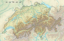
Piz Dado is a mountain peak of the Glarus Alps, situated above Breil/Brigels in the canton of Graubünden. It is the most eastern peak of the Brigelser Hörner just next to Piz Dadens (2772 m).
| Piz Dado | |
|---|---|
| Highest point | |
| Elevation | 2,698 m (8,852 ft) |
| Prominence | 89 m (292 ft)[1] |
| Parent peak | Tödi |
| Coordinates | 46°47′27.1″N 9°00′55.5″E / 46.790861°N 9.015417°E |
| Geography | |
| Country | Switzerland |
| Canton | Graubünden |
| Parent range | Glarus Alps |
| Topo map | Swiss Federal Office of Topography swisstopo |
References
edit- ^ Retrieved from the Swisstopo topographic maps and Google Earth. The key col is located west of the summit at 2,610 metres.
External links
edit
