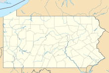
Penn Valley Airport (IATA: SEG[2], ICAO: KSEG, FAA LID: SEG) is a public airport in Monroe Township, Snyder County, and is a mile north of Selinsgrove, a borough in Snyder County, Pennsylvania. It is owned by the Penn Valley Airport Authority.[1] The National Plan of Integrated Airport Systems for 2011–2015 categorized it as a general aviation facility.[3]
Penn Valley Airport | |||||||||||
|---|---|---|---|---|---|---|---|---|---|---|---|
 | |||||||||||
| Summary | |||||||||||
| Airport type | Public | ||||||||||
| Owner | Penn Valley Airport Authority | ||||||||||
| Serves | Selinsgrove, Pennsylvania | ||||||||||
| Elevation AMSL | 463 ft / 141 m | ||||||||||
| Coordinates | 40°49′16″N 076°51′51″W / 40.82111°N 76.86417°W | ||||||||||
| Map | |||||||||||
 | |||||||||||
| Runways | |||||||||||
| |||||||||||
| Statistics (2012) | |||||||||||
| |||||||||||
Facilities and aircraft
editPenn Valley Airport covers 149 acres (60 ha) at an elevation of 463 feet (141 m). Its one runway, 17/35, is 4,760 by 75 feet (1,451 x 23 m) asphalt.[1]
In the year ending March 7, 2012 the airport had 28,000 aircraft operations, average 76 per day: 87% general aviation, 12% air taxi, and 1% military. 30 aircraft were then based at the airport: 67% single-engine, 13% ultralight, 10% multi-engine, 7% jet, and 3% helicopter.[1]
Accidents and incidents
edit- On August 23, 1987 a Piper PA-23-160 registered N4003P with three on-board crashed on takeoff killing all those aboard. The pilot and owner of the aircraft Karl Kovacs was taking two others on a scenic flight of the Susquehanna Valley. However the aircraft was overweight and in low ceilings and fog, Kovacs struggled to gain altitude and was in a high pitch angle and stalled at approximately 750 feet. The cause was determined to be pilot error and gross overload of the Piper.[4][5]
- On October 4, 2013 a Piper PA-22 crashed on the runway during an attempted takeoff. Two people were seriously injured, National Transportation Safety Board and the Federal Aviation Administration investigated stating the cause was the "pilots failure to perform pre-flight check elevator trim would have shown the aircraft wasn't airworthy."[6]
See also
editReferences
edit- ^ a b c d FAA Airport Form 5010 for SEG PDF. Federal Aviation Administration. Effective May 31, 2012.
- ^ "IATA Airport Code Search (SEG: Selinsgrove / Penn Valley)". International Air Transport Association. Retrieved December 11, 2012.
- ^ "Appendix A: List of NPIAS Airports with 5-Year Forecast Activity and Development Cost". National Plan of Integrated Airport Systems (NPIAS) Reports. Federal Aviation Administration. October 4, 2010. Archived from the original on 2012-10-27.
- ^ "Piper PA-23 incident in Selinsgrove, PA - NTSB/FAA". ntsb.gov.
- ^ Ranter, Harro. "Accident Piper PA-23-160 N4003P, 28 Aug 1987". aviation-safety.net. Retrieved 2019-02-24.
- ^ "ERA14LA015". www.ntsb.gov. Retrieved 2019-02-24.
External links
edit- Penn Valley Airport at Pennsylvania DOT Bureau of Aviation
- Heritage Aviation, the fixed-base operator (FBO)
- Aerial image as of April 1999 from USGS The National Map
- FAA Terminal Procedures for SEG, effective October 31, 2024
- Resources for this airport:
- FAA airport information for SEG
- AirNav airport information for KSEG
- ASN accident history for SEG
- FlightAware airport information and live flight tracker
- NOAA/NWS weather observations: current, past three days
- SkyVector aeronautical chart, Terminal Procedures

