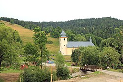
Osturňa (Hungarian: Osztornya, German: Asthorn, Rusyn: Остурня) is a village and municipality in Kežmarok District in the Prešov Region of north Slovakia.[5] The village was traditionally inhabited by Greek Catholic Rusyns and Gorals, as one of their westernmost settlements (together with Malá Franková and Veľká Franková).
Osturňa | |
|---|---|
Village | |
 Church of Saint Michael in Osturňa | |
| Coordinates: 49°20′N 20°14′E / 49.333°N 20.233°E | |
| Country | Slovakia |
| Region | Prešov |
| District | Kežmarok |
| Area | |
• Total | 41.28[2] km2 (15.94[2] sq mi) |
| Elevation | 723[3] m (2,372[3] ft) |
| Population (2021) | |
• Total | 285[1] |
| Postal code | 059 79[3] |
| Area code | +421 52[3] |
| Car plate | KK |
| Website | http://osturna.e-obce.sk |
Geography
editThe municipality lies at an altitude of 717 meters and covers an area of 41.237 km² . It has a population of about 329 full-time residents.
History
editIn historical records the village was first mentioned in 1593. Before the establishment of independent Czechoslovakia in 1918, Osturňa was part of Szepes County within the Kingdom of Hungary. From 1939 to 1945, it was part of the Slovak Republic. On 27 January 1945, the Red Army dislodged the Wehrmacht from Osturňa in the course of the Western Carpathian offensive and it was once again part of Czechoslovakia.
Economy
editLocals in the past had been engaged in agriculture and pasturage. At present its proximity of Ždiar and High Tatras is an asset. Inhabitants work in industrial facilities in Poprad or in recreational facilities in High Tatras. Inside the village are quite a few cottages and chalets for winter or summer holiday rent.
References
edit- ^ "Počet obyvateľov podľa pohlavia - obce (ročne)". www.statistics.sk (in Slovak). Statistical Office of the Slovak Republic. 2022-03-31. Retrieved 2022-03-31.
- ^ a b "Hustota obyvateľstva - obce [om7014rr_ukaz: Rozloha (Štvorcový meter)]". www.statistics.sk (in Slovak). Statistical Office of the Slovak Republic. 2022-03-31. Retrieved 2022-03-31.
- ^ a b c d "Základná charakteristika". www.statistics.sk (in Slovak). Statistical Office of the Slovak Republic. 2015-04-17. Retrieved 2022-03-31.
- ^ a b "Hustota obyvateľstva - obce". www.statistics.sk (in Slovak). Statistical Office of the Slovak Republic. 2022-03-31. Retrieved 2022-03-31.
- ^ "Statistical Office of the Slovak Republic" (PDF). Výsledky SODB 2011. Štatistický úrad SR. Retrieved 9 August 2012.
External links
edit- Osturňa - The Carpathian Connection
- http://www.obec-osturna.sk/ Official homepage
