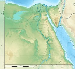
Ostrakine (Ancient Greek: Ὀστρακίνη, Latin: Ostracena, Coptic: ⲟⲥⲧⲣⲁⲕⲓⲛⲏ, ⲧⲣⲁⲕⲓⲛⲏ) was an ancient Egyptian city at a location that is known as Ras Straki (Arabic: راس ستركي) or Gazirat El-Felusiyat (Arabic: جزيرة الفلوسيات) today.[1]
Ostrakine
Ὀστρακίνη Ras Straki راس ستركي | |
|---|---|
| Coordinates: 31°7′17.6″N 33°25′27.69″E / 31.121556°N 33.4243583°E | |
| Country | |
| Governorate | North Sinai |
The name of the Zaraniq Protected Area (Arabic: الزرانيق) is also derived from Ostrakine.[2]
Etymology
editThe city's name is believed to be derived from the Greek word "οστρακινος," meaning "earthen" or "made of clay," which is based on the word "οστρακον," meaning "earthen vessel" or "potsherd." The name is sometimes translated as "city of sherds" and is thought to refer to a concentration of potsherds found on the spot. While some scholars have suggested that the name may also be translated as "city of shells," this interpretation is less likely due to the lack of usage of the term "οστρακινος" in this context.[3]
Location
editOstrakine was located on the road between Alexandria and Gaza at Lake Bardawil, a saltwater lagoon near the Mediterranean coast of the northern Sinai.
History
editEstablished as a harbour in the first century BC,[4] near Sirbonis, the longtime border between Egypt and Syria,[5] archaeological evidence suggests that Ostrakine was a centre of glass-making in the classical period.[6] A bishopric during the Byzantine period, there is evidence of three Byzantine churches,[7] and that the town remained important as a stop along the trade route in the early Muslim period.[8]
Tradition
editOstrakine has traditionally been thought to be the site of the tomb of the prophet Habakkuk[9] and the martyrdom of James the Less[10]
Madaba Map
editOstrakine is depicted on the Madaba Map [2]
See also
editNotes
edit- ^ "4care-sites – 4care". Retrieved 2023-03-24.
- ^ Maspero, Jean; Wiet, Gaston (1919). "Materiaux pour servir à la Géographie de l'Égypte". Journal of the Royal Asiatic Society. 53 (4): 230.
- ^ Verreth, Herbert (2006). The northern Sinai from the 7th century BC till the 7th century AD. A guide to the sources. Vol. 1. Leuven. p. 357.
- ^ Oked, Sarit, "Patterns of the Transport Amphorae at Ostrakine During the 6th Century", ARAM Periodical Peeters Online Journal, 1996, Vol 8 No.1 [1][permanent dead link]
- ^ Mooren, Léon, Lake Serbonis and Sabkhat Bardaawill, Peeters Publishers, p. 474
- ^ Katholieke Universiteit, Leuven, Sargalassos Archaeological Research Project, Glass as subject of study Archived 2010-08-22 at the Wayback Machine
- ^ Figueras, Pau, "The Road Linking Palestine and Egypt along the Sinai Coast, The Madaba Mosaic Map" Archived 2013-01-03 at the Wayback Machine retrieved 09-08-10
- ^ Horden, Peregrine and Purcell, Nicholas, The Corrupting Sea, a Study of Mediterranean history, Wiley-Blackwell p. 171
- ^ "Figueras". Archived from the original on 2013-01-03. Retrieved 2013-01-17.
- ^ A religious encyclopædia: or, Dictionary of Biblical, historical, doctrinal and practical theology, New York: 1910, Funk & Wagnalls, p. 1140
