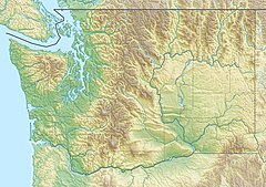
The North Fork Touchet River is the primary headwater of the Touchet River, flowing 21.7 miles (34.9 km)[2] through Columbia County, Washington.[1] The river begins in the Blue Mountains in a ravine just east of Ski Bluewood.[3] It flows north, past the Touchet Corral Sno-Park,[4] in a narrow valley between Chase Mountain to the west and Middle Point Ridge to the east.[3] It is joined by Spangler, Lewis and Jim Creeks from the right before receiving the Wolf Fork from the left.[5] An unnamed tributary from the right forms Hompegg Falls just downstream of Spangler Creek.[5] Below the Wolf Fork it flows northwest through a wider valley before joining the South Fork Touchet River at Baileysburg, south of Dayton, to form the main stem of the Touchet.[6]
| North Fork Touchet River | |
|---|---|
| Location | |
| Country | United States |
| State | Washington |
| County | Columbia |
| Physical characteristics | |
| Source | Near Ski Bluewood |
| • location | Blue Mountains |
| • coordinates | 46°04′29″N 117°50′08″W / 46.07472°N 117.83556°W[1] |
| • elevation | 5,500 ft (1,700 m) |
| Mouth | Touchet River |
• location | South of Dayton |
• coordinates | 46°18′04″N 117°57′31″W / 46.30111°N 117.95861°W[1] |
• elevation | 1,667 ft (508 m)[1] |
| Length | 21.7 mi (34.9 km)[2] |
| Basin size | 101.7 sq mi (263 km2)[2] |
See also
editReferences
edit- ^ a b c d "North Fork Touchet River". Geographic Names Information System. United States Geological Survey, United States Department of the Interior. September 10, 1979. Retrieved February 19, 2024.
- ^ a b c United States Geological Survey. National Hydrography Dataset high-resolution flowline data. The National Map, accessed February 18, 2024
- ^ a b U.S. Geological Survey. "U.S. Geological Survey Topographic Map: Godman Spring, Washington quad". TopoQuest. Retrieved February 18, 2024.
- ^ "Touchet Corral Sno-Park". U.S. Forest Service. Retrieved February 19, 2024.
- ^ a b U.S. Geological Survey. "U.S. Geological Survey Topographic Map: Eckler Mountain, Washington quad". TopoQuest. Retrieved February 18, 2024.
- ^ U.S. Geological Survey. "U.S. Geological Survey Topographic Map: Dayton, Washington quad". TopoQuest. Retrieved February 18, 2024.
