Ngawa County (Tibetan: རྔ་བ་རྫོང་།, Wylie: rnga ba rdzong, ZYPY: Ngawa Zong, Chinese: 阿坝县; pinyin: Ābà Xiàn), or Aba or Ngaba, is a county in the northwest of Sichuan Province, China. It is under the administration of the Ngawa Tibetan and Qiang Autonomous Prefecture. It is located in the remote northwestern part of the prefecture, on the border with Qinghai (to the northwest) and Gansu (to the north). The county seat is Ngawa Town.[2]
Ngawa County
阿坝县 • རྔ་བ་རྫོང་། • Rrmeabba Ngaba, Aba | |
|---|---|
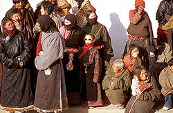
 People of Ngawa County | |
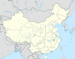
 Location of Ngawa County (red) within Ngawa Prefecture (yellow) and Sichuan | |
| Coordinates: 32°54′N 101°42′E / 32.900°N 101.700°E | |
| Country | China |
| Province | Sichuan |
| Autonomous prefecture | Ngawa |
| County seat | Ngawa Town |
| Area | |
| • Total | 10,435 km2 (4,029 sq mi) |
| Population (2020)[1] | |
| • Total | 80,467 |
| • Density | 7.7/km2 (20/sq mi) |
| Time zone | UTC+8 (China Standard) |
| Website | www |
| Ngawa County | |||||||
|---|---|---|---|---|---|---|---|
| Chinese name | |||||||
| Simplified Chinese | 阿坝县 | ||||||
| Traditional Chinese | 阿壩縣 | ||||||
| |||||||
| Tibetan name | |||||||
| Tibetan | རྔ་བ་རྫོང་། | ||||||
| |||||||
| Qiang name | |||||||
| Qiang | Rrmeabba | ||||||
Self-immolation incident
editOn 16 March 2011 a 20-year-old Tibetan monk called Phuntsok set fire to himself at a market, in protest against allegedly repressive government policies in Tibet Autonomous Region and other Tibetan populated areas in China.[3] He died in hospital early in the morning of 17 March. Following Phuntsok's self-immolation, hundreds of monks from the same monastery, Kirti monastery in Ngaba County, and other local residents staged another protest.
Climate
edit| Climate data for Ngawa County, elevation 3,275 m (10,745 ft), (1991–2020 normals, extremes 1981–2010) | |||||||||||||
|---|---|---|---|---|---|---|---|---|---|---|---|---|---|
| Month | Jan | Feb | Mar | Apr | May | Jun | Jul | Aug | Sep | Oct | Nov | Dec | Year |
| Record high °C (°F) | 18.1 (64.6) |
19.1 (66.4) |
22.1 (71.8) |
25.7 (78.3) |
26.5 (79.7) |
27.0 (80.6) |
28.0 (82.4) |
27.2 (81.0) |
27.1 (80.8) |
26.4 (79.5) |
17.6 (63.7) |
17.7 (63.9) |
28.0 (82.4) |
| Mean daily maximum °C (°F) | 4.5 (40.1) |
7.0 (44.6) |
10.0 (50.0) |
13.8 (56.8) |
16.3 (61.3) |
18.2 (64.8) |
20.4 (68.7) |
20.4 (68.7) |
17.8 (64.0) |
13 (55) |
8.9 (48.0) |
5.2 (41.4) |
13.0 (55.3) |
| Daily mean °C (°F) | −6.3 (20.7) |
−3.0 (26.6) |
1.2 (34.2) |
5.5 (41.9) |
8.8 (47.8) |
11.7 (53.1) |
13.4 (56.1) |
12.9 (55.2) |
10.3 (50.5) |
5.2 (41.4) |
−0.8 (30.6) |
−5.5 (22.1) |
4.5 (40.0) |
| Mean daily minimum °C (°F) | −14.2 (6.4) |
−10.7 (12.7) |
−5.4 (22.3) |
−1.1 (30.0) |
2.9 (37.2) |
6.7 (44.1) |
8.0 (46.4) |
7.3 (45.1) |
5.3 (41.5) |
0.2 (32.4) |
−7.2 (19.0) |
−12.7 (9.1) |
−1.7 (28.9) |
| Record low °C (°F) | −29.3 (−20.7) |
−28.4 (−19.1) |
−18.2 (−0.8) |
−9.0 (15.8) |
−5.2 (22.6) |
−1.3 (29.7) |
−0.2 (31.6) |
−1.5 (29.3) |
−3.5 (25.7) |
−12.0 (10.4) |
−20.7 (−5.3) |
−26.9 (−16.4) |
−29.3 (−20.7) |
| Average precipitation mm (inches) | 4.9 (0.19) |
9.5 (0.37) |
22.9 (0.90) |
36.1 (1.42) |
96.9 (3.81) |
139.8 (5.50) |
120.6 (4.75) |
108.0 (4.25) |
108.2 (4.26) |
60.7 (2.39) |
8.1 (0.32) |
2.9 (0.11) |
718.6 (28.27) |
| Average precipitation days | 3.9 | 6.0 | 10.1 | 13.4 | 20.9 | 22.6 | 20.4 | 18.8 | 20.0 | 16.7 | 4.5 | 3.0 | 160.3 |
| Average snowy days | 5.9 | 8.2 | 13.9 | 10.6 | 3.6 | 0.1 | 0.1 | 0.1 | 0.3 | 6.4 | 7.3 | 4.5 | 61 |
| Average relative humidity (%) | 55 | 54 | 58 | 60 | 65 | 72 | 75 | 75 | 75 | 73 | 64 | 58 | 65 |
| Mean monthly sunshine hours | 212.8 | 190.4 | 211.8 | 220.3 | 211.6 | 177.5 | 204.9 | 203.2 | 180.4 | 190.2 | 216.1 | 223.8 | 2,443 |
| Percent possible sunshine | 67 | 61 | 57 | 56 | 49 | 42 | 47 | 50 | 49 | 55 | 70 | 72 | 56 |
| Source: China Meteorological Administration[4][5] | |||||||||||||
Administrative divisions
editNgawa County comprises 6 towns and 9 townships:
| Name | Simplified Chinese | Hanyu Pinyin | Tibetan | Wylie | Administrative division code | |
|---|---|---|---|---|---|---|
| Towns | ||||||
| Ngawa Town (Aba) |
阿坝镇 | Ābà Zhèn | རྔ་བ་གྲོང་རྡལ། | rnga ba grong rdal | 513231100 | |
| Jialuo Town (Jialuo) |
贾洛镇 | Jiǎluò Zhèn | གཅའ་རུ་གྲོང་བརྡལ། | gcav ru grong brdal | 513231101 | |
| Miuruma Town (Meruma, Mai'erma) |
麦尔玛镇 | Mài'ěrmǎ Zhèn | རྨེའུ་རུ་མ་གྲོང་རྡལ། | rmevu ru ma grong rdal | 513231102 | |
| Zhocog Town (Hocig, Hezhi) |
河支镇 | Hézhī Zhèn | སྤྲོ་ཚོགས་གྲོང་རྡལ། | spro tshogs grong rdal | 513231103 | |
| Gomang Town (Gemo) |
各莫镇 | Gèmò Zhèn | སྒོ་མང་གྲོང་རྡལ། | sgo mang grong rdal | 513231104 | |
| Akam Town (Ankyam, Anqiang) |
安羌镇 | Ānqiāng Zhèn | ཨ་གམས་གྲོང་རྡལ། | a gams grong rdal | 513231105 | |
| Townships | ||||||
| Mêugor Township (Mêgor, Maikun) |
麦昆乡 | Màikūn Xiāng | རྨེའུ་སྐོར་ཡུལ་ཚོ། | rmevu skor yul tsho | 513231201 | |
| Loincang Township (Longzang) |
龙藏乡 | Lóngzàng Xiāng | བློན་ཚང་ཡུལ་ཚོ། | blon tshang yul tsho | 513231203 | |
| Qoijêma Township (Qiujima) |
求吉玛乡 | Qiújímǎ Xiāng | ཆོས་རྗེ་མ་ཡུལ་ཚོ། | chos rje ma yul tsho | 513231204 | |
| Suwa Township (Siwa) |
四洼乡 | Sìwā Xiāng | བསུ་བ་ཤང་། | bsu ba shang | 513231208 | |
| Andü Township (Andou) |
安斗乡 | Āndǒu Xiāng | ཨ་འདུས་ཡུལ་ཚོ། | a vdus yul tsho | 513231209 | |
| Kogbo Township (Kehe) |
柯河乡 | Kēhé Xiāng | ཁོག་པོ་ཡུལ་ཚོ། | khog po yul tsho | 513231210 | |
| Karsar Township (Karsa, Kuasha) |
垮沙乡 | Kuǎshā Xiāng | མཁར་སར་ཡུལ་ཚོ། | mkhar sar yul tsho | 513231211 | |
| Cainxi Township (Chali) |
查理乡 | Chálǐ Xiāng | མཚན་ཞིད་ཡུལ་ཚོ། | mtshan zhid yul tsho | 513231213 | |
| Rongwam Township (Rong'an) |
茸安乡 | Róng'ān Xiāng | རོང་ཝམ་ཡུལ་ཚོ། | rong wam yul tsho | 513231214 | |
Footnotes
edit- ^ "阿坝州第七次全国人口普查公报第二号——县(市)人口情况" (in Chinese). Government of Ngawa Prefecture. 2021-06-11.
- ^ Dorje (2009), pp. 778-781.
- ^ Buckley, Chris. "Tibetan monk burns to death in China protest - group". Reuters. Archived from the original on 19 March 2011. Retrieved 15 February 2012.
- ^ 中国气象数据网 – WeatherBk Data (in Simplified Chinese). China Meteorological Administration. Retrieved 13 April 2023.
- ^ 中国气象数据网 (in Simplified Chinese). China Meteorological Administration. Retrieved 13 April 2023.
References
edit- *Dorje, Gyurme (2009). Footprint Tibet Handbook. Footprint Books. ISBN 978-1-906098-32-2.

