This article needs additional citations for verification. (November 2023) |
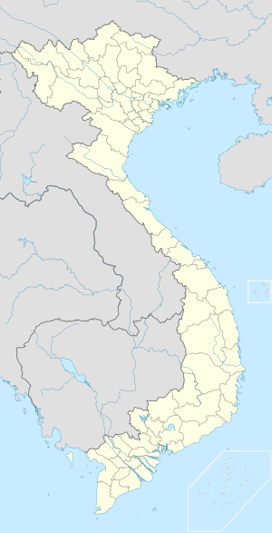
Mũi Né is a coastal fishing town in the south-central Bình Thuan Province of Vietnam. The town, with approximately 25,000 residents, is a ward of the city of Phan Thiết. Mui Ne and the other wards of Phan Thiet stretch along the coast for approximately 50 kilometers and have been transformed into a resort destination since the mid-1990s, when many visited the area to view the solar eclipse of October 24, 1995.
Mui Ne
Phường Mũi Né | |
|---|---|
 Fishing boats in Mũi Né harbour | |
| Nickname(s): "The resort capital of Vietnam"[1] "Thủ đô resort của Việt Nam" | |
| Coordinates: 10°56′N 108°17′E / 10.933°N 108.283°E | |
| Country | |
| Province | Bình Thuận |
| City | Phan Thiet |
| Population (2005) | |
| • Religions | Buddhism |
Mũi Né ward has two beaches; Ganh Beach and Suoi Nuoc Beach, both with a number of resorts and a few shops and restaurants. But the most highly developed area is Rang Beach in Ham Tien ward (often erroneously called "Mui Ne Beach" by foreigners), which extends west of Mui Ne.
The tourist season is from December to April. The average temperature is 27 °C, and the climate is hot and dry much of the year.
Geography
editMũi Né ward is geographically located as follows: - To the east and south, it borders the East Sea. - To the west, it borders Hàm Tiến ward and Thiện Nghiệp commune. - To the north, it borders Thiện Nghiệp commune and Bắc Bình district.
The ward covers an area of 35.41 km², with a population of 24,275 as of 1999, resulting in a population density of 686 people per km².
History
editDuring the Republic of Vietnam era, Mũi Né was the district capital of Hải Long district, Bình Thuận province.[2][3] After 1975, Hải Long district merged with Hàm Thuận and Thiện Giáo districts to form Hàm Thuận district, Thuận Hải province.[4] At that time, Mũi Né was part of Hàm Dũng commune, Hàm Thuận district.[2]
On March 13, 1979, the Government Council issued Decision 104-CP[5]. According to this decision, Hàm Dũng commune was dissolved to establish Mũi Né town as the district capital of Hàm Thuận district.[6]
On December 30, 1982, the Council of Ministers issued Decision 204-HĐBT[7][8]. According to this decision, Hàm Thuận district was divided into two new districts: Hàm Thuận Bắc and Hàm Thuận Nam.[9][10][11] At the same time, Mũi Né town was placed under the administration of Phan Thiết town and was renamed Mũi Né ward.
Culture
editCuisine
editMui Ne is famous for seafood. Sand dunes are inhabited by the iguana, called Dong in Vietnamese. It is a reptile, quite similar to the lizard, but larger and longer. Local people cook iguana in seven ways: grilled, steamed, fried, roasted, raw, served in porridge, iguana pie, and served alongside vegetables. Therefore, the local people call this the seven dishes from iguana.
Beaches
edit- Mui Ne Beach: The main stretch of coastline.
- Ham Tien Beach: A quieter beach with beachfront resorts.
- Hon Rom Beach: A secluded beach.
Gallery
edit-
Hot Air Balloon over white sand dunes
-
White sand dunes: view from hot air balloon
-
Cham Tower at Phu Hai
-
Local fishermen
-
Fisherman at Mũi Né Beach
-
Fishing at dawn near Mũi Né
-
Before the storm
-
Mũi Né Fairy Stream
-
Kitesurfing on the beach
-
Kitesurfing on the beach
-
Harbour
-
Fishing boats in harbour
-
Sand dunes
-
Sand dunes
References
edit- ^ "Sai Gon Suoi Nhum Resort, Quang Binh Hotels, Vietnam Hotel, Quang Binh Accommodation, Quang Binh Hotels Guide,Quang Binh Hotels,Hotels in Quang Binh,Quang Binh Hotel,Hotel in Quang Binh,Quang Binh Hotels Accommodation,Quang Binh Hotels Room". Archived from the original on 2010-10-13. Retrieved 2010-10-10.
- ^ a b "Đảng bộ phường mũi né" (PDF). Ban Tuyên giáo Tỉnh ủy Bình Thuận (in Vietnamese). 2019-09-13. Retrieved 2024-11-16.
- ^ "Một thời ghe bầu Mũi Né". Báo Bình Thuận (in Vietnamese). 2019-09-13. Retrieved 2024-11-16.
- ^ "Lịch sử đơn vị 430 hàm thuận" (PDF). Ban Tuyên giáo Tỉnh ủy Bình Thuận (in Vietnamese). 2019-09-13. Retrieved 2024-11-16.
- ^ "Quyết định 104-CP điều chỉnh địa giới xã thị trấn huyện thuộc tỉnh Thuận Hải". THƯ VIỆN PHÁP LUẬT. 2021-05-07. Retrieved 2024-11-16.
- ^ "LỊCH SỬ ĐẢNG BỘ PHƯỜNG MŨI NÉ - Thành uỷ Phan Thiết" (PDF). Thành uỷ Phan Thiết. 2021-05-07. Retrieved 2024-11-16.
- ^ "Quyết định 204-HĐBT phân vạch địa giới huyện thị xã thuộc tỉnh Thuận Hải". THƯ VIỆN PHÁP LUẬT. 2020-10-12. Retrieved 2024-11-16.
- ^ "Quyết định số 204/HĐBT của Hội đồng Bộ trưởng: Quyết định về việc phân vạch địa giới một số huyện và thị xã thuộc tỉnh Ninh Thuận". vanban.chinhphu.vn (in Vietnamese). Retrieved 2024-11-16.
- ^ "Vùng đất anh hùng Hàm Thuận Bắc vươn lên thoát nghèo". BÁO SÀI GÒN GIẢI PHÓNG (in Vietnamese). 2023-04-08. Retrieved 2024-11-16.
- ^ Nguyen, Nam (2023-11-02). "789bet". Retrieved 2024-11-16.
- ^ "Hàm Thuận Bắc: Những thành tựu nổi bật qua 40 năm xây dựng và phát triển". hamthuanbac.binhthuan.dcs.vn. Retrieved 2024-11-16.
External links
edit- Mui Ne travel guide from Wikivoyage
10°56′N 108°17′E / 10.933°N 108.283°E
