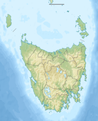
Mount Achilles is a mountain that is part of the Du Cane Range, located in the Cradle Mountain-Lake St Clair National Park in Tasmania, Australia. With an elevation of 1,353 metres (4,439 ft) above sea level, the peak is the 46th highest mountain in Tasmania.
| Mount Achilles | |
|---|---|
 | |
| Highest point | |
| Elevation | 1,363 m (4,472 ft)AHD[1] |
| Prominence | 173 m (568 ft)[1] |
| Parent peak | unnamed peak 1,520 m (4,990 ft) |
| Isolation | 1.31 km (1 mi)[1] |
| Listing | Highest mountains of Tasmania |
| Coordinates | 41°51′30″S 145°58′40″E / 41.85833°S 145.97778°E[2] |
| Geography | |
| Location | Tasmania, Australia |
| Range coordinates | 41°56′24″S 146°02′24″E / 41.94000°S 146.04000°E |
| Parent range | Du Cane Range |
| Geology | |
| Rock age | Jurassic |
| Mountain type | Dolerite |
Mount Achilles consists of two main summits, the highest is known as 'Achilles Heel', and the other is referred to as 'Perrins Bluff'.[3] It is located in the more northern part of the park, and almost due east of Zeehan[4] It is a major feature of the national park, and is a popular venue with bushwalkers and mountain climbers.[5]
See also
editReferences
edit- ^ a b c "Mount Achilles, Australia". Peakbagger.com. Retrieved 30 May 2017.
- ^ "Du Cane Range (TAS)". Gazetteer of Australia online. Geoscience Australia, Australian Government.
- ^ Tasmania. Dept. of Primary Industries, Parks, Water and Environment (2010). Achilles (Map) (2nd ed.). TASMAP publication by the Dept. of Primary Industries, Parks, Water and Environment. Retrieved 13 July 2012.
{{cite map}}: CS1 maint: multiple names: authors list (link) - ^ "Mount Achilles (Tasmania) – Climbing, Hiking & Mountaineering". Mountain Forecast. 2017. Retrieved 30 May 2017.
- ^ "Photograph - Mt Achilles from Track on Pelion Plains". LINC One Search. State Library of Tasmania, Government of Tasmania. Retrieved 30 May 2017.
External links
edit
