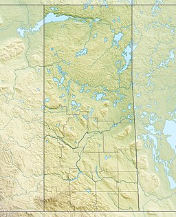
Moosomin Lake,[1] also known as Moosomin Reservoir, is a man-made lake in south-eastern part of the Canadian province of Saskatchewan. Created by the damming of Pipestone Creek in 1954, Moosomin Lake is located about 10 kilometres (6.2 mi) south of the town of Moosomin and is in the Souris River watershed. The reservoir's uses include irrigation, water supply, and recreation. Moosomin Lake Regional Park is on lake's western shore.[2]
| Moosomin Lake | |
|---|---|
 Moosomin Lake Regional Park | |
| Location | Saskatchewan |
| Coordinates | 50°04′00″N 101°42′02″W / 50.06667°N 101.70056°W |
| Lake type | Reservoir |
| Primary inflows | Pipestone Creek |
| Primary outflows | Pipestone Creek |
| Basin countries | Canada |
| Managing agency | Saskatchewan Water Security Agency |
| First flooded | 1954 |
| Max. length | 8 km (5.0 mi) |
| Surface area | 389 ha (960 acres) |
| Max. depth | 8.4 m (28 ft) |
| Water volume | 11,156 dam3 (9,044 acre⋅ft) |
| Shore length1 | 30.1 km (18.7 mi) |
| Surface elevation | 544 m (1,785 ft) |
| 1 Shore length is not a well-defined measure. | |
The town of Moosomin gets its drinking water from wells alongside the lake. From the wells, the water is piped to town. In 2022, $10 million in funding was approved to upgrade the water treatment plant.[3][4]
In 2011, much of the Souris River watershed flooded in a greater-than-one-in-a-hundred year flood event. While the well shacks are a few feet higher than the normal water level in Moosomin Lake, due to the rising water levels, sandbags had to be used around the wells to protect them from being contaminated. After the waters receded, permanent three-foot clay dykes were built at the well site to protect the wells from future potential flooding.[5]
Geology
editMoosomin Lake sits in the Pipestone Valley, which was created about 15,000 years ago with the melting of the last ice age. The valley was cut by the melting waters from glacial Lake Indian Head and is called the Pipestone Spillway.[6]
Moosomin Dam
editThe construction of Moosomin Dam (50°02′52″N 101°41′26″W / 50.0478°N 101.6905°W) along the Pipestone Creek began in 1953 and work was completed by November 1954. It is an earth-filled embankment dam located at the south-east corner of Moosomin Lake that is 13.5 metres (44 ft) high with an uncontrolled overflow concrete spillway and a gated riparian outlet. The maximum discharge capacity is 448 m3 (15,800 cu ft) per second. The total length of the reservoir when full is 8 kilometres (5.0 mi) long with a total storage capacity of 11,156 dam3 (394,000,000 cu ft). The surface area for the reservoir is 389 hectares (960 acres).[7]
An $9.7 million[8] rehabilitation project on the dam was begun in 2023. The project involves adding a 300 mm (12 in) thick concrete slab to the top of the existing spillway, upgrades to the embankment road, improvement to the drainage system, erosion prevention work, and improvement to the movement monitoring system. Work is expected to be completed by the summer of 2024.[9][10]
Moosomin Lake Regional Park
editMoosomin Lake Regional Park (50°04′42″N 101°42′38″W / 50.0784°N 101.7106°W)[11] opened up in 1955 along the western shore of the lake. The regional park is about 14 kilometres (8.7 mi) from the town of Moosomin and can be accessed from Highway 709, which is just off Highway 8. The park features camping, swimming, and boating. There are 125 serviced campsites plus unserviced over-flow sites. The beach area of the park has a sandy beach, a picnic area, and a playground.[12] There are also boat launches and a marina that was built in 2015.[13] Just outside the park, to the east near the dam and along Highway 8, is the 9-hole Pipestone Hills Golf Course.[14]
See also
editReferences
edit- ^ "Moosomin Lake". Canadian Geographical Names Database. Government of Canada. Retrieved 10 June 2023.
- ^ "Moosomin Lake Regional Park". Moosomin Regional Park. Retrieved 15 March 2024.
- ^ Weedmark, Kevin (1 May 2022). "$10 million grant approved for Moosomin water plant". The World Spectator. Retrieved 15 March 2024.
- ^ "Moosomin Reservoir Fishing Map". GPS Nautical Charts. Bist LLC. Retrieved 15 March 2024.
- ^ Weedmark, Kevin (16 April 2013). "Potential spring flooding: St. Lazare putting faith in dykes, Moosomin builds dykes around wells". The World Spectator. Retrieved 15 March 2024.
- ^ "The Qu'Appelle Valley". University of Regina. Retrieved 15 March 2024.
- ^ "Moosomin Dam Information for Dam Safety Review 2016" (PDF). Buy and Sell. Government of Canada. Retrieved 10 June 2023.
- ^ "Sask. Water Security Agency spends $18M on infrastructure projects". CKOM News. Rawlco Radio Ltd. 15 July 2024. Retrieved 16 July 2024.
- ^ Kiedrowski, Ryan. "$8.8 million Moosomin Dam rehab on schedule". Moosomin.com. Moosomin Chamber of Commerce. Retrieved 15 March 2024.
- ^ Kiedrowski, Ryan (16 November 2023). "Upgrades continue at Moosomin Dam". SaskToday.ca. Glacier Media Group. Retrieved 16 March 2024.
- ^ "Moosomin Lake and District Regional Park". Canadian Geographical Names Database. Government of Canada. Retrieved 10 June 2023.
- ^ "Moosomin & District". Regional Parks of Saskatchewan. Saskatchewan Regional Parks. Retrieved 15 March 2024.
- ^ "Fishing". Moosomin Regional Park. Retrieved 15 March 2024.
- ^ Club, Pipestone Hills Golf. "Pipestone Hills Golf Club - Golf Course - Moosomin, Saskatchewan". Pipestone Hills Golf Course.

