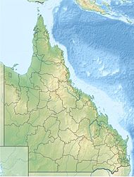
Mooroobool is a western suburb of Cairns in the Cairns Region, Queensland, Australia.[2] In the 2021 census, Mooroobool had a population of 7,136 people.[1]
| Mooroobool Cairns, Queensland | |||||||||||||||
|---|---|---|---|---|---|---|---|---|---|---|---|---|---|---|---|
 View across Mooroobool from Coreega Close, 2018 | |||||||||||||||
 | |||||||||||||||
| Coordinates | 16°56′10″S 145°43′47″E / 16.9361°S 145.7297°E | ||||||||||||||
| Population | 7,136 (2021 census)[1] | ||||||||||||||
| • Density | 1,551/km2 (4,020/sq mi) | ||||||||||||||
| Postcode(s) | 4870 | ||||||||||||||
| Area | 4.6 km2 (1.8 sq mi) | ||||||||||||||
| Time zone | AEST (UTC+10:00) | ||||||||||||||
| Location |
| ||||||||||||||
| LGA(s) | Cairns Region | ||||||||||||||
| State electorate(s) | Cairns | ||||||||||||||
| Federal division(s) | Leichhardt | ||||||||||||||
| |||||||||||||||
Geography
editMooroobool is 5.5 kilometres (3.4 mi) by road west of the Cairns central business district.[3]
Mooroobool has a mixture of dwellings which are mainly residential and commercial properties. Nearby suburbs are Earlville and Kanimbla.
History
editMooroobool is situated in the Yidinji traditional Aboriginal country.[4]
The suburb was named by the Queensland Place Names Board on 1 September 1973.[2] The origin of the suburb name is from the geographical feature Mooroobool Peak located west from the suburb, named from an Aboriginal word meaning 'meeting of the waters'.[5]
Kingsford Street is named after Richard Ash Kingsford, who was mayor of Cairns from 1885-1886 and in 1889.[6]
Balaclava State School opened on 2 February 1954.[7]
Demographics
editIn the 2006 census, Mooroobool had a population of 6,618people.[8]
In the 2016 census, Mooroobool had a population of 7,222 people.[9]
In the 2021 census, Mooroobool had a population of 7,136 people.[1]
Education
editBalaclava State School is a government primary (Prep-6) school for boys and girls at 418 Mulgrave Road (16°56′12″S 145°44′42″E / 16.9367°S 145.7449°E).[10][11] In 2017, the school had an enrolment of 353 students with 31 teachers (29 full-time equivalent) and 26 non-teaching staff (17 full-time equivalent).[12] The school has a special education program.[10]
There are no secondary schools in Mooroobool. The nearest government secondary schools are Trinity Bay State High School in neighbouring Manunda to the north-east and Woree State High School in Woree to the south-east.[13]
Amenities
editMooroobool has a Campbell’s Super IGA and a police beat.[citation needed]
Attractions
editCampbells Lookout is on Lake Morris Road (16°55′56″S 145°43′20″E / 16.9322°S 145.7222°E).[14] It provides good views across Cairns.[15]
References
edit- ^ a b c Australian Bureau of Statistics (28 June 2022). "Mooroobool (SAL)". 2021 Census QuickStats. Retrieved 28 February 2023.
- ^ a b "Mooroobool – suburb in Cairns Region (entry 48772)". Queensland Place Names. Queensland Government. Retrieved 26 January 2020.
- ^ "Cairns CBD to Mooroobool" (Map). Google Maps. Retrieved 11 September 2024.
- ^ "First people cultural history". Cairns Regional Council. Retrieved 23 June 2020.
- ^ "M Suburbs" (PDF). Cairns Regional Council. Retrieved 23 June 2020.
- ^ "Mayors of Cairns 1885 to Present" (PDF). Cairns Heritage Page. Cairns Regional Council. Retrieved 2 April 2014.
- ^ Queensland Family History Society (2010), Queensland schools past and present (Version 1.01 ed.), Queensland Family History Society, ISBN 978-1-921171-26-0
- ^ Australian Bureau of Statistics (25 October 2007). "Mooroobool (Cairns City) (State Suburb)". 2006 Census QuickStats. Retrieved 13 June 2011.
- ^ Australian Bureau of Statistics (27 June 2017). "Mooroobool (SSC)". 2016 Census QuickStats. Retrieved 20 October 2018.
- ^ a b "State and non-state school details". Queensland Government. 9 July 2018. Archived from the original on 21 November 2018. Retrieved 21 November 2018.
- ^ "Balaclava State School". Balaclava State School. 29 November 2020. Retrieved 29 August 2024.
- ^ "ACARA School Profile 2017". Archived from the original on 22 November 2018. Retrieved 22 November 2018.
- ^ "Layers: Locality; Schools and school catchments". Queensland Globe. Queensland Government. Retrieved 9 September 2024.
- ^ "Campbells Lookout – lookout in Cairns Regional (entry 5994)". Queensland Place Names. Queensland Government. Retrieved 20 May 2024.
- ^ "Campbells Lookout". Our Place - We Are Cairns West. Retrieved 10 September 2024.
External links
edit- "Cairns Suburbs". Queensland Places. University of Queensland.
